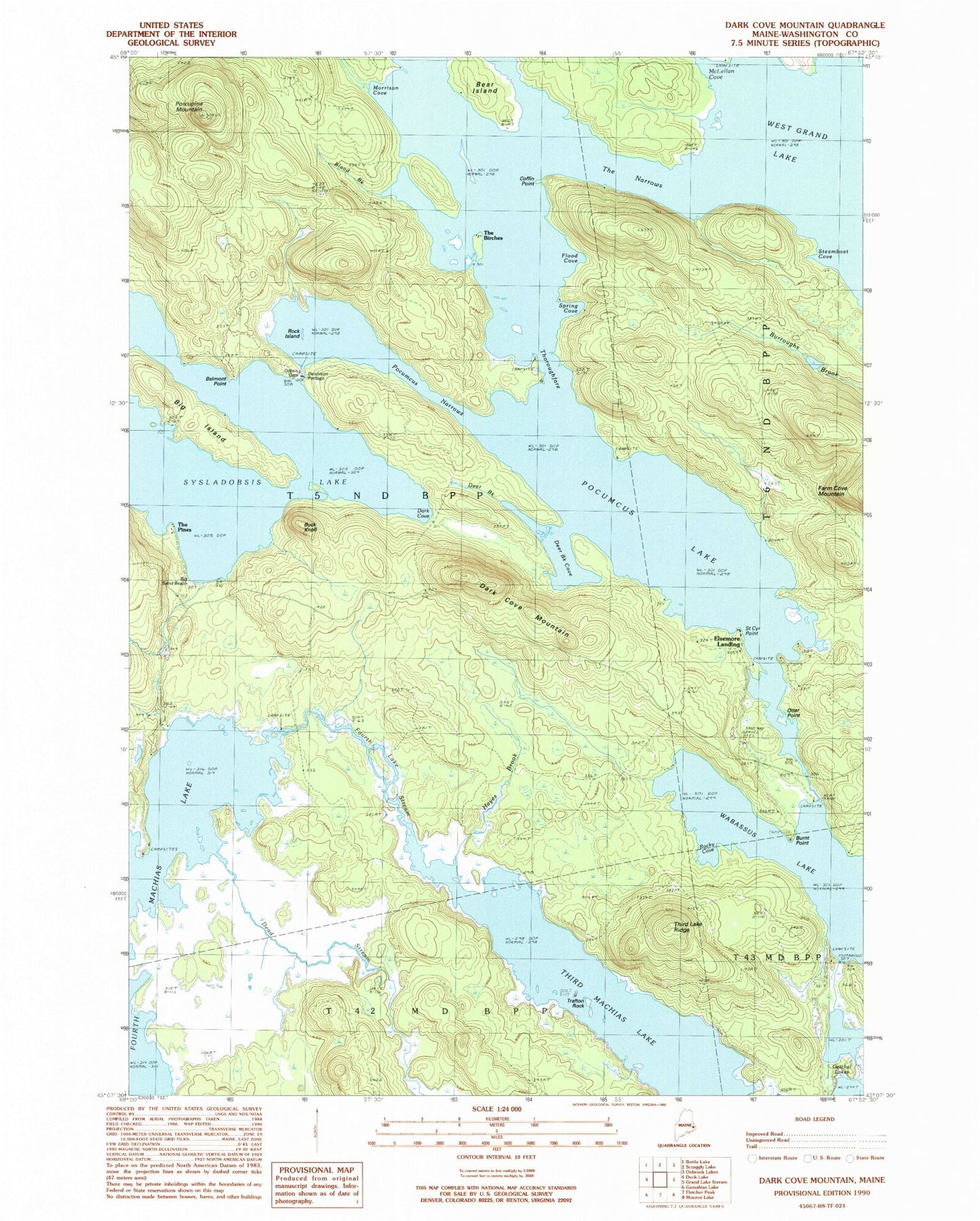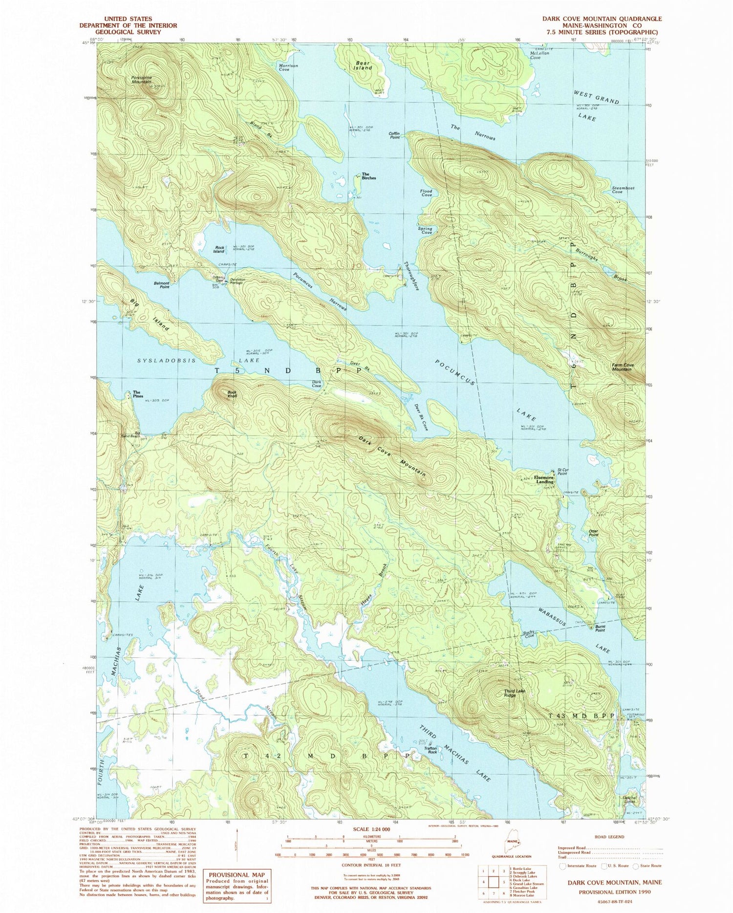
MyTopo
Classic USGS Dark Cove Mountain Maine 7.5'x7.5' Topo Map
Couldn't load pickup availability
Historical USGS topographic quad map of Dark Cove Mountain in the state of Maine. Typical map scale is 1:24,000, but may vary for certain years, if available. Print size: 24" x 27"
This quadrangle is in the following counties: Washington.
The map contains contour lines, roads, rivers, towns, and lakes. Printed on high-quality waterproof paper with UV fade-resistant inks, and shipped rolled.
Contains the following named places: Bear Island, Belmont Point, Big Island, Big Sand Beach, Blood Brook, Buck Knoll, Burnt Point, Coffin Point, Dark Cove, Dark Cove Mountain, Dead Stream, Deer Brook, Deer Brook Cove, Dennison Portage, Flood Cove, Fourth Lake Stream, Fourth Machias Lake, Getchel Lakes, Hayes Brook, McLellan Cove, Morrison Cove, Otter Point, Pocumcus Lake, Pocumcus Narrows, Porcupine Mountain, Rock Island, Rocky Cove, Spring Cove, Steamboat Cove, The Birches, The Narrows, Third Lake Ridge, Trafton Rock, Unknown Stream, Wabassus Lake, St. Cyr Point, Elsemore Landing, Jumbo Landing, The Pines, Dobsis Dam, Sakom Township