MyTopo
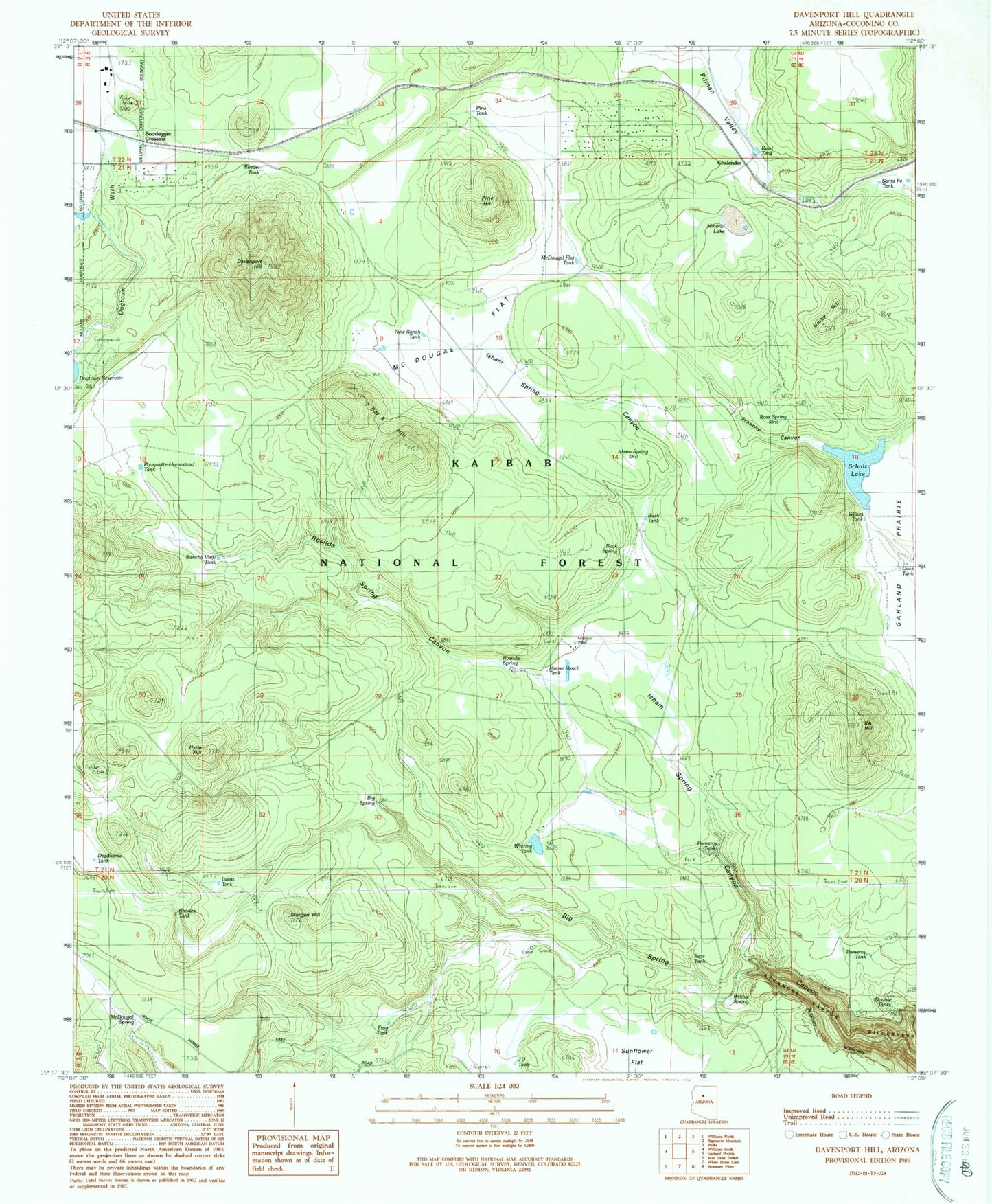
Classic USGS Davenport Hill Arizona 7.5'x7.5' Topo Map
Couldn't load pickup availability
Historical USGS topographic quad map of Davenport Hill in the state of Arizona. Typical map scale is 1:24,000, but may vary for certain years, if available. Print size: 24" x 27"
This quadrangle is in the following counties: Coconino.
The map contains contour lines, roads, rivers, towns, and lakes. Printed on high-quality waterproof paper with UV fade-resistant inks, and shipped rolled.
Contains the following named places: Big Spring, Buck Spring, Chalender, Davenport Hill, DeadHorse Tank, Frenchy Canyon, Horse Hill, Hyde Hill, Isham Spring, KA Hill, McDougal Flat, McDougal Flat Tank, McDougal Spring, Mineral Lake, Moose Well, Morgan Hill, New Ranch Tank, Pine Hill, Pitman Valley, Pomeroy Tanks, Pouquette Homestead Tank, Reeder Tank, Rhodes Tank, Rosilda Spring, Ross Spring, Seven Bar K Hill, Sunflower Flat, Willow Spring, Bear Tank, Bootlegger Crossing, Cat Tank, Dogtown Reservoir Recreation Site, Dogtown Tank, Isham Spring Canyon, JD Cabin, Pine Tank, Rancho Viejo Tank, Rosilda Spring Canyon, Scholz Lake, Sherwood Forest Estates, Whiting Tank, JD Tank, Duck Tank, Lucas Tank, Pomeroy Tank, Reed Tank, Wilkes Tank, Moose Ranch Tank, Buck Tank, Frog Tank, Double Tanks, Santa Fe Tank, Dogtown Campground, Horse Hill Wildlife Guzzler, Buck Wildlife Guzzler, Sycamore Rim Trail, Sherwood Forest Fire District