MyTopo
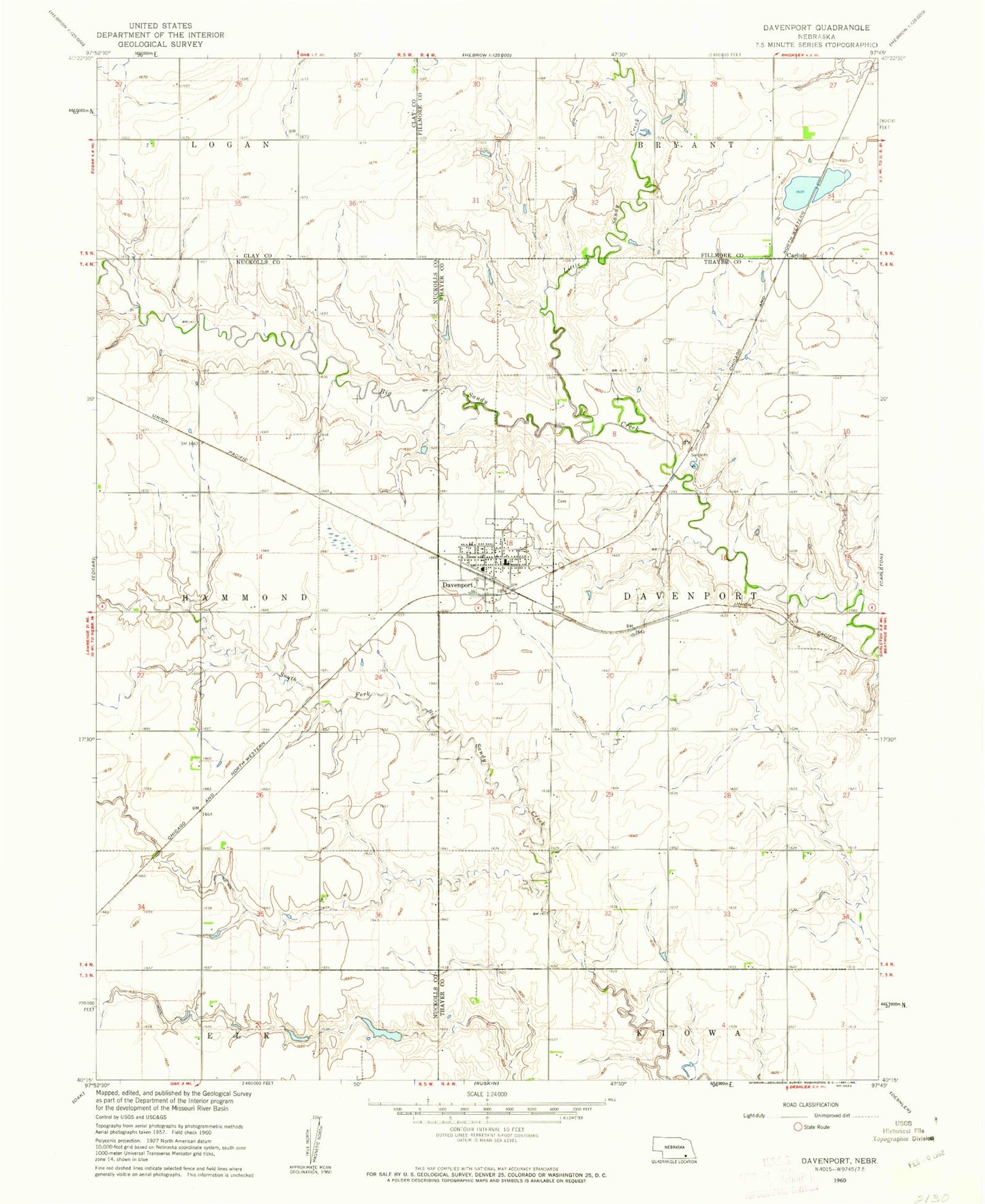
Classic USGS Davenport Nebraska 7.5'x7.5' Topo Map
Couldn't load pickup availability
Historical USGS topographic quad map of Davenport in the state of Nebraska. Map scale may vary for some years, but is generally around 1:24,000. Print size is approximately 24" x 27"
This quadrangle is in the following counties: Clay, Fillmore, Nuckolls, Thayer.
The map contains contour lines, roads, rivers, towns, and lakes. Printed on high-quality waterproof paper with UV fade-resistant inks, and shipped rolled.
Contains the following named places: Carlisle, Carlisle Post Office, Christs Lutheran Church, Davenport, Davenport Community Schools, Davenport Medical Clinic, Davenport Post Office, Davenport Public Library, Davenport Volunteer Fire and Rescue, Grone Airport, Hammond Election Precinct, Happy Hollow School, Jagels Dam, Jagels Reservoir, Jennings Dam, Jennings Reservoir, Little Sandy Creek, Pleasant Hill School, R and R Farms Airport, Saint Peters Lutheran Church, Saint Peters Lutheran Elementary School, Schroeder Dam, Schroeder Reservoir, Township of Davenport, Township of Hammond, United Methodist Church, Valley View School, Village of Davenport, ZIP Code: 68335