
MyTopo
Classic USGS Davis Knolls Utah 7.5'x7.5' Topo Map
Regular price
$16.95
Regular price
Sale price
$16.95
Unit price
per
Couldn't load pickup availability
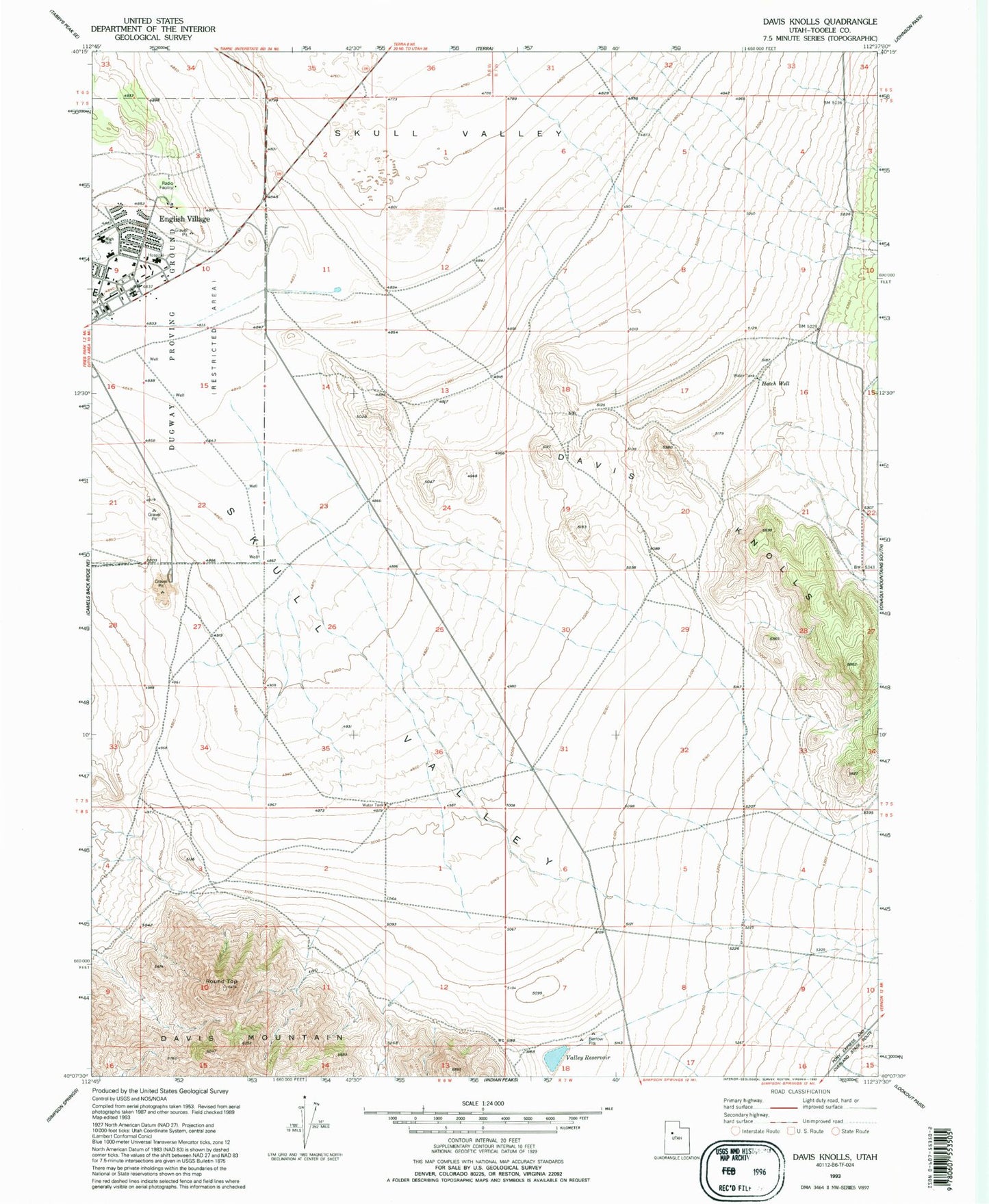
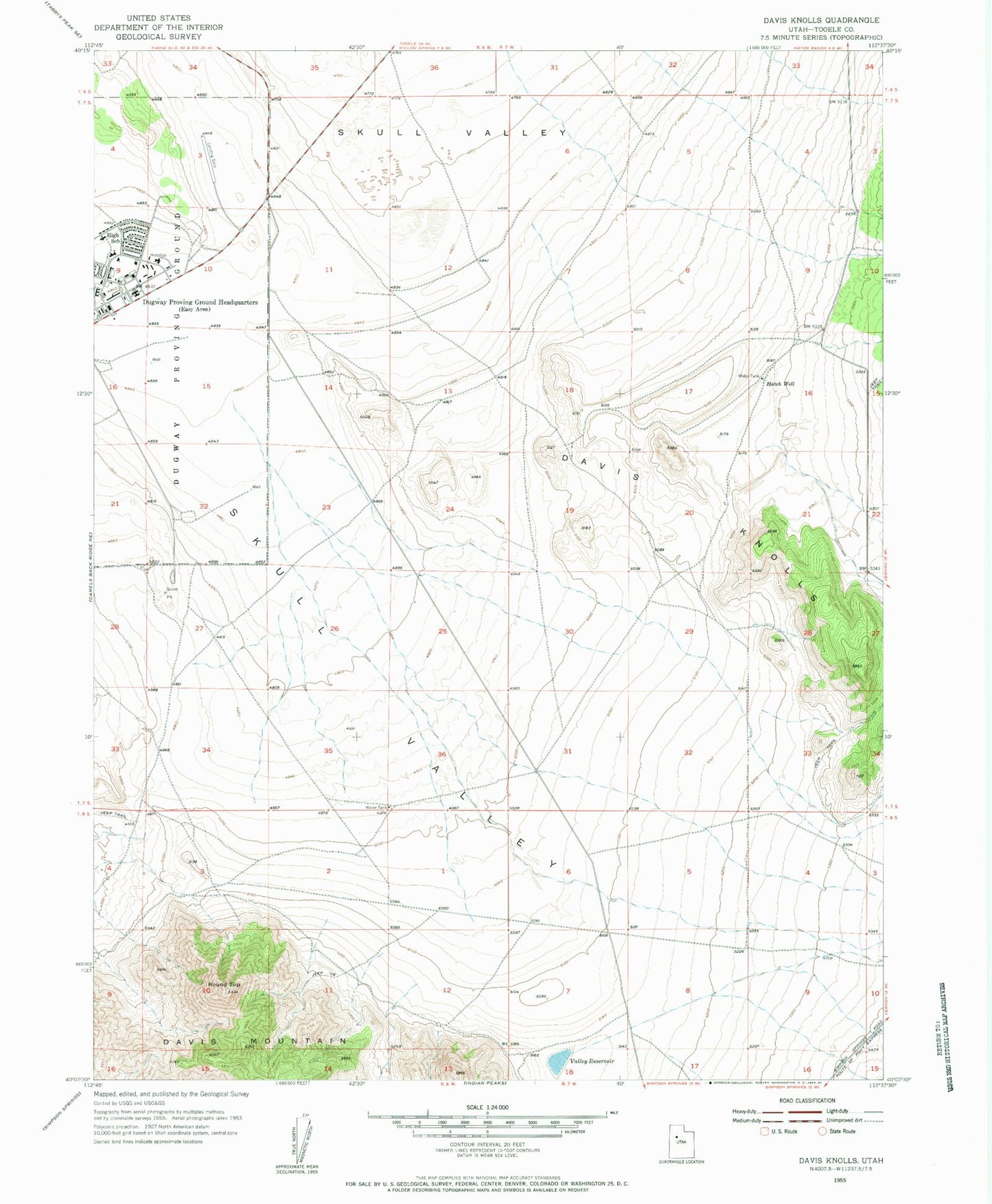
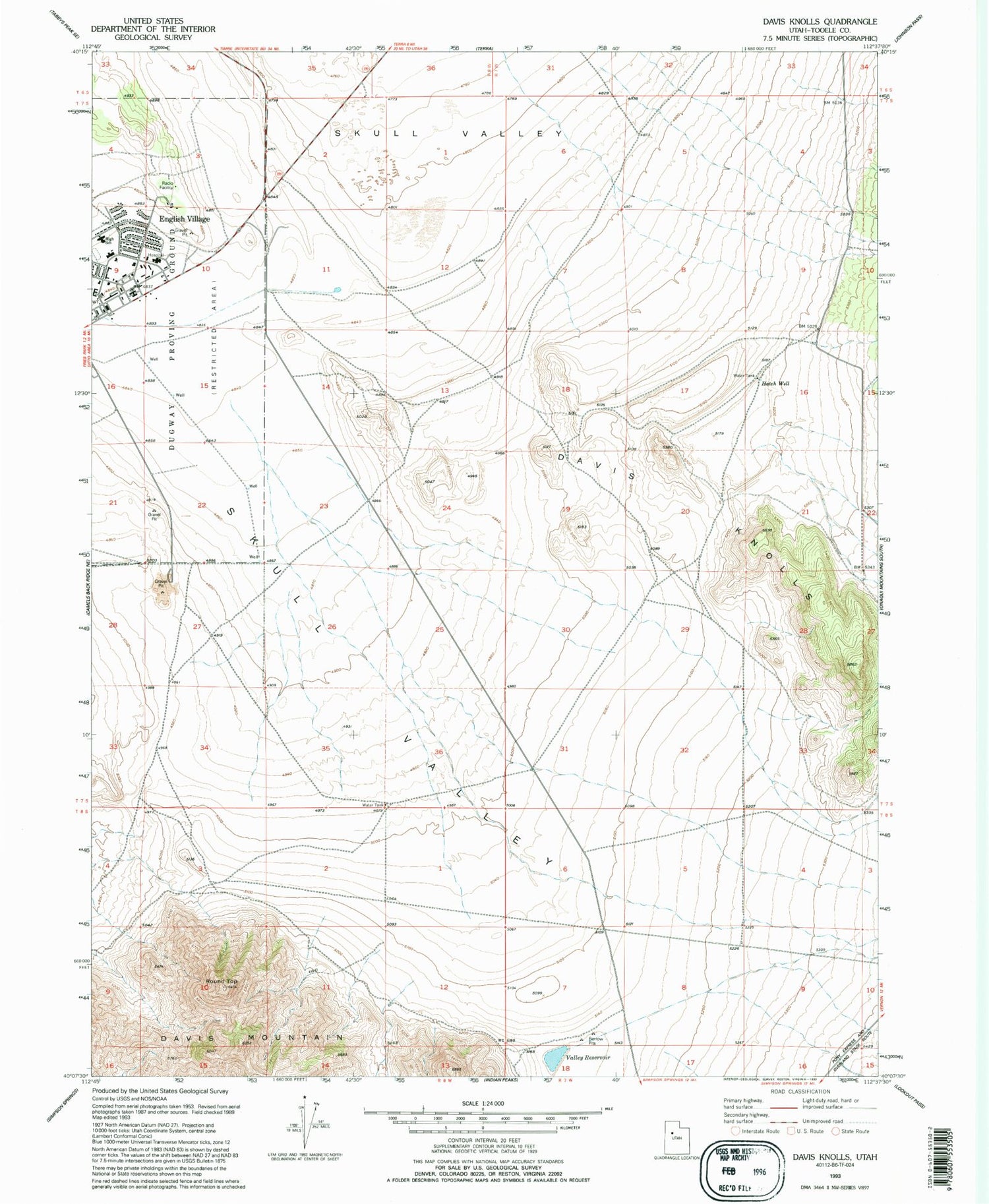
Historical USGS topographic quad map of Davis Knolls in the state of Utah. Map scale may vary for some years, but is generally around 1:24,000. Print size is approximately 24" x 27"
This quadrangle is in the following counties: Tooele.
The map contains contour lines, roads, rivers, towns, and lakes. Printed on high-quality waterproof paper with UV fade-resistant inks, and shipped rolled.
Contains the following named places: Davis Knolls, Davis Mountain, Dry Creek, Dugway, Dugway Elementary School, Dugway Fire Department, Dugway High School, Dugway Post Office, Hatch Well, Round Top, The Church of Jesus Christ of Latter Day Saints, Valley Reservoir