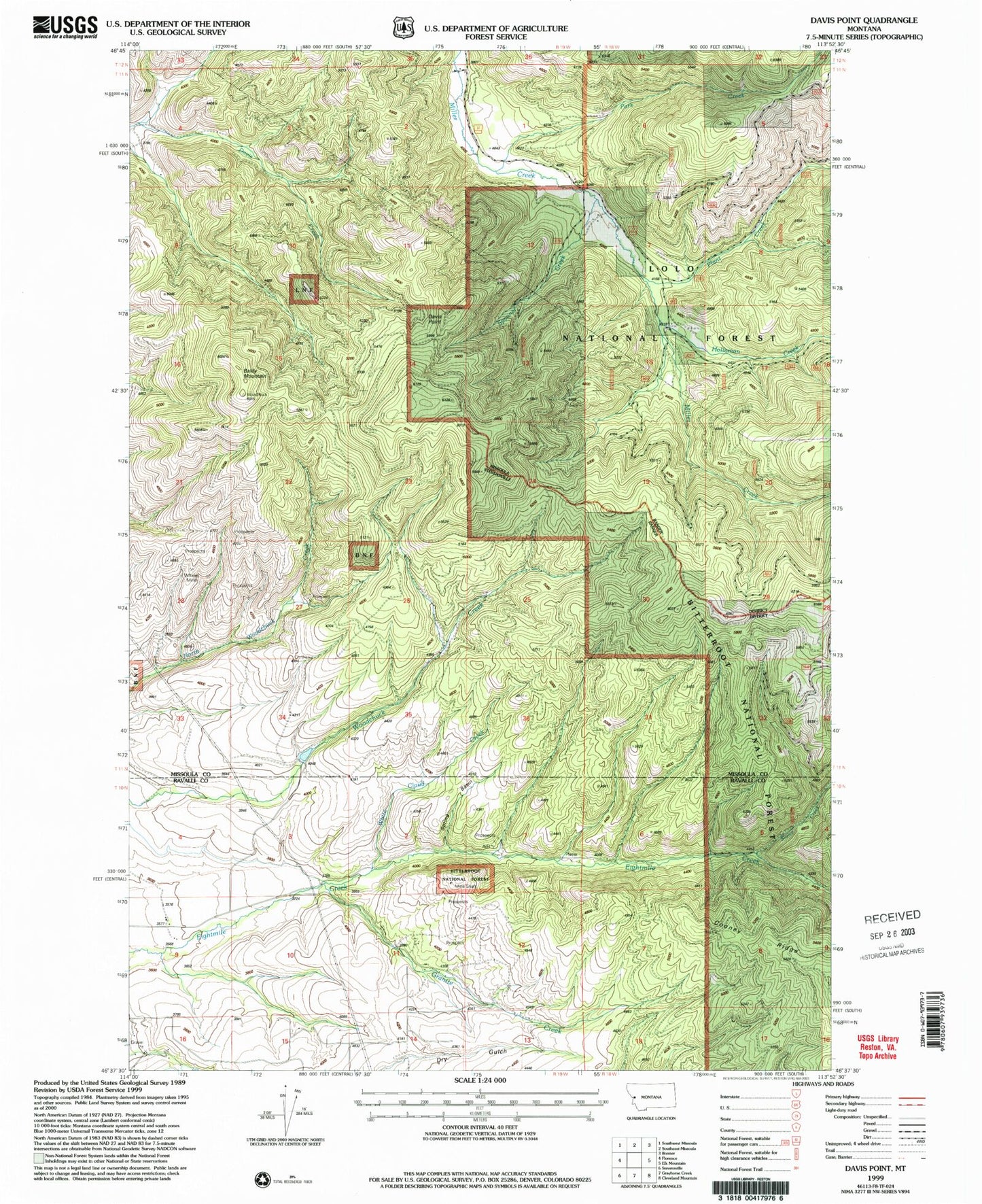
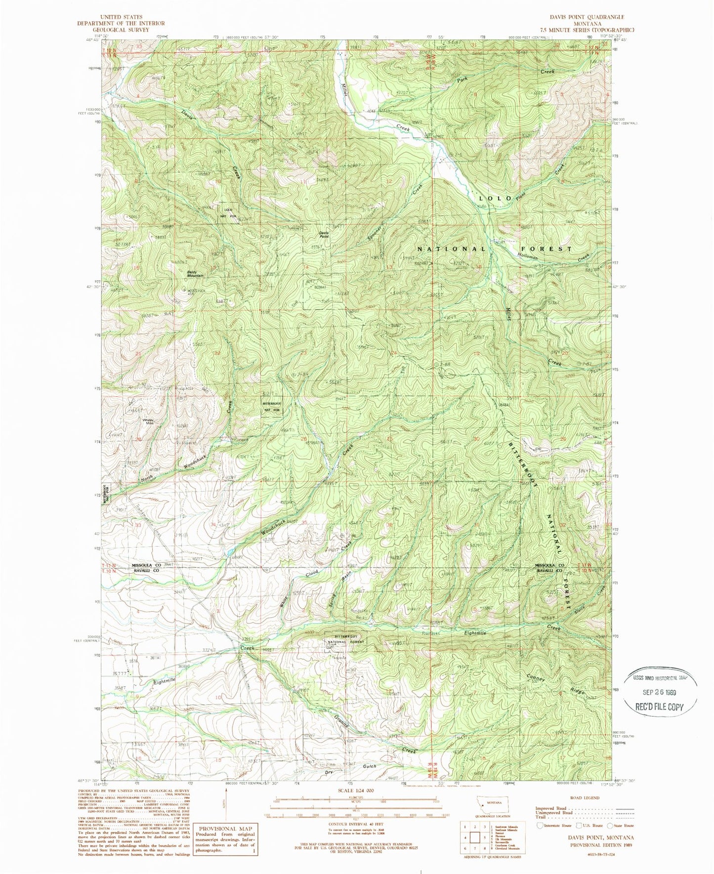
MyTopo
Classic USGS Davis Point Montana 7.5'x7.5' Topo Map
Couldn't load pickup availability
Historical USGS topographic quad map of Davis Point in the state of Montana. Map scale may vary for some years, but is generally around 1:24,000. Print size is approximately 24" x 27"
This quadrangle is in the following counties: Missoula, Ravalli.
The map contains contour lines, roads, rivers, towns, and lakes. Printed on high-quality waterproof paper with UV fade-resistant inks, and shipped rolled.
Contains the following named places: 10N19W09ABCC01 Well, Baldy Mountain, Berry Rush Mine, Davis Point, Eight Mile, Eight Mile Creek Placer Mine, Eight Mile School, Granite Creek, Holloman Creek, NW SE Section 2 Mine, Park Creek, Plant Creek, Pyretees Post Office, Red Rock Mine, SE NE Section 11 Mine, Sluice Creek, Spooner Creek, Spring Basin, Waldbilling Mine, Whaley Mine, White Cloud Creek, White Cloud Mine, Woodchuck Dam