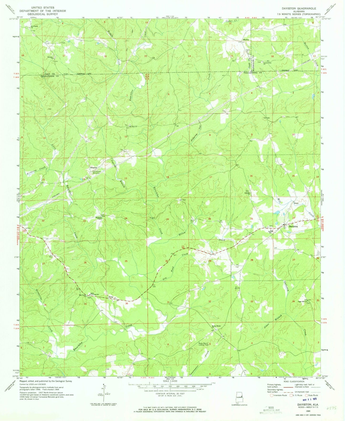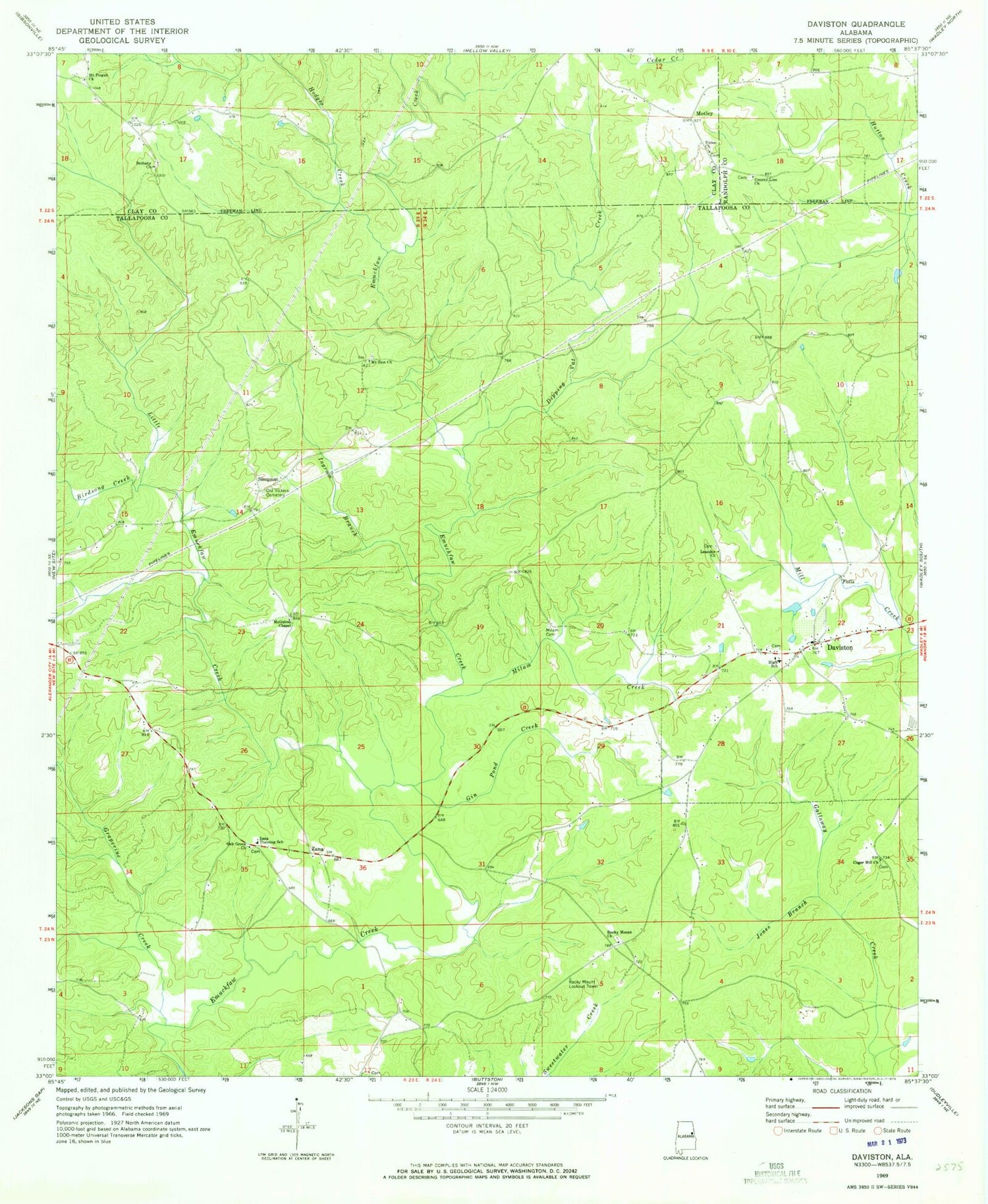
MyTopo
Classic USGS Daviston Alabama 7.5'x7.5' Topo Map
Couldn't load pickup availability
Historical USGS topographic quad map of Daviston in the state of Alabama. Map scale may vary for some years, but is generally around 1:24,000. Print size is approximately 24" x 27"
This quadrangle is in the following counties: Clay, Randolph, Tallapoosa.
The map contains contour lines, roads, rivers, towns, and lakes. Printed on high-quality waterproof paper with UV fade-resistant inks, and shipped rolled.
Contains the following named places: Bethany Cemetery, Bethany Primitive Baptist Church, Birdsong Creek, Coger Hill Church, County Line Baptist Church, County Line Cemetery, Daviston, Daviston Baptist Church, Daviston Cemetery, Daviston High School, Daviston Methodist Church, Daviston Post Office, Daviston Volunteer Fire Department, Dipping Vat Creek, Emuckfaw, Emuckfaw Battleground, Gin Pond Creek, Grapevine Creek, Hodges Creek, Ingram Branch, Jones Branch, Leander Church, Little Emuckfaw Creek, McGuires Chapel, Milam Cemetery, Milam Creek, Motley, Mount Pisgah Church, Mount Zion Church, Mountain Church, Mountain School, New Site Division, Oak Grove Church, Old Vickers Cemetery, Rocky Mount Lookout Tower, Rocky Mount Primitive Baptist Church, Simpson, Town of Daviston, Union Baptist Church, Union Cemetery, Zana, Zana Training School, ZIP Code: 36256