
MyTopo
Classic USGS Davisville Alabama 7.5'x7.5' Topo Map
Couldn't load pickup availability
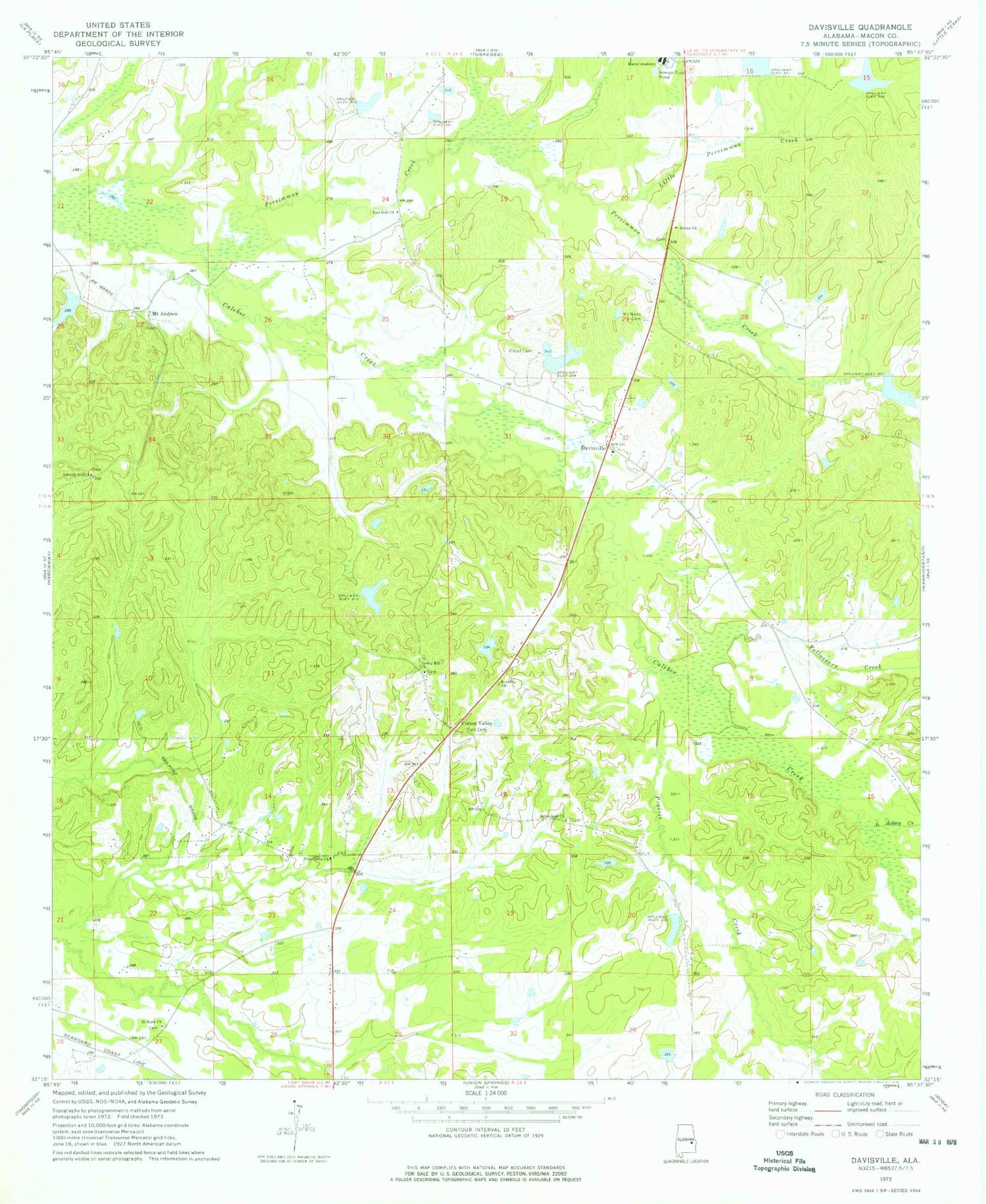
Historical USGS topographic quad map of Davisville in the state of Alabama. Map scale may vary for some years, but is generally around 1:24,000. Print size is approximately 24" x 27"
This quadrangle is in the following counties: Macon.
The map contains contour lines, roads, rivers, towns, and lakes. Printed on high-quality waterproof paper with UV fade-resistant inks, and shipped rolled.
Contains the following named places: Bethlehem Cemetery, Bethlehem Church, Cloud Cemetery, Cotton Valley, Cotton Valley Church, Cotton Valley School, Davisville, Fort Cemetery, Fort Davis Division, Fort Hull Church, Fort Hull School, H A Vaughn Junior Number 1 Dam, Howard Dam, Howard Lamar Dam, Lake Russell, Lake Wadsworth, Liberty Hill, Liberty Hill Cemetery, Liberty Hill Church, Liberty Hill School, Ligon Cemetery, Little Acorn Creek, Little Persimmon Creek, Macon Academy, Mount Andrew, Mount Andrew Church, Mount Andrews Cemetery, Mount Nebo Baptist Church, Mount Nebo Cemetery, Mount Nebo School, Old Hog Wallow Lake, Ostette Dam, Persimmon Creek, Pine Grove Church, Prairie Creek, Saint Mark Baptist Church, Saint Mark Cemetery, Shiloh Cemetery, Shiloh Church, Spring Hill Church, Tallassarr Creek, Tysons Lake, W M Russell Junior Dam, W T Wadsworth Dam, Whitlow Cemetery


