MyTopo
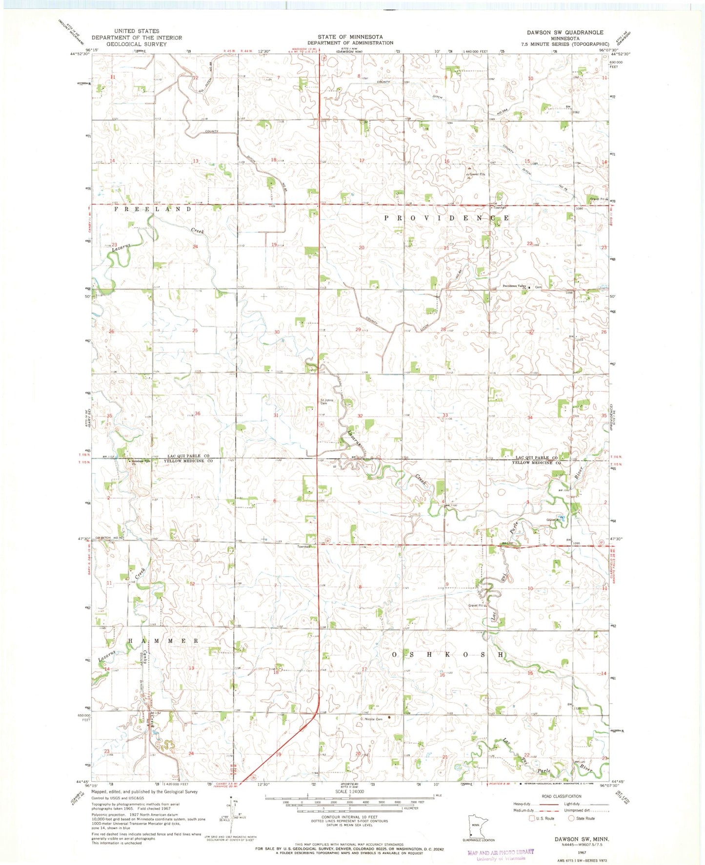
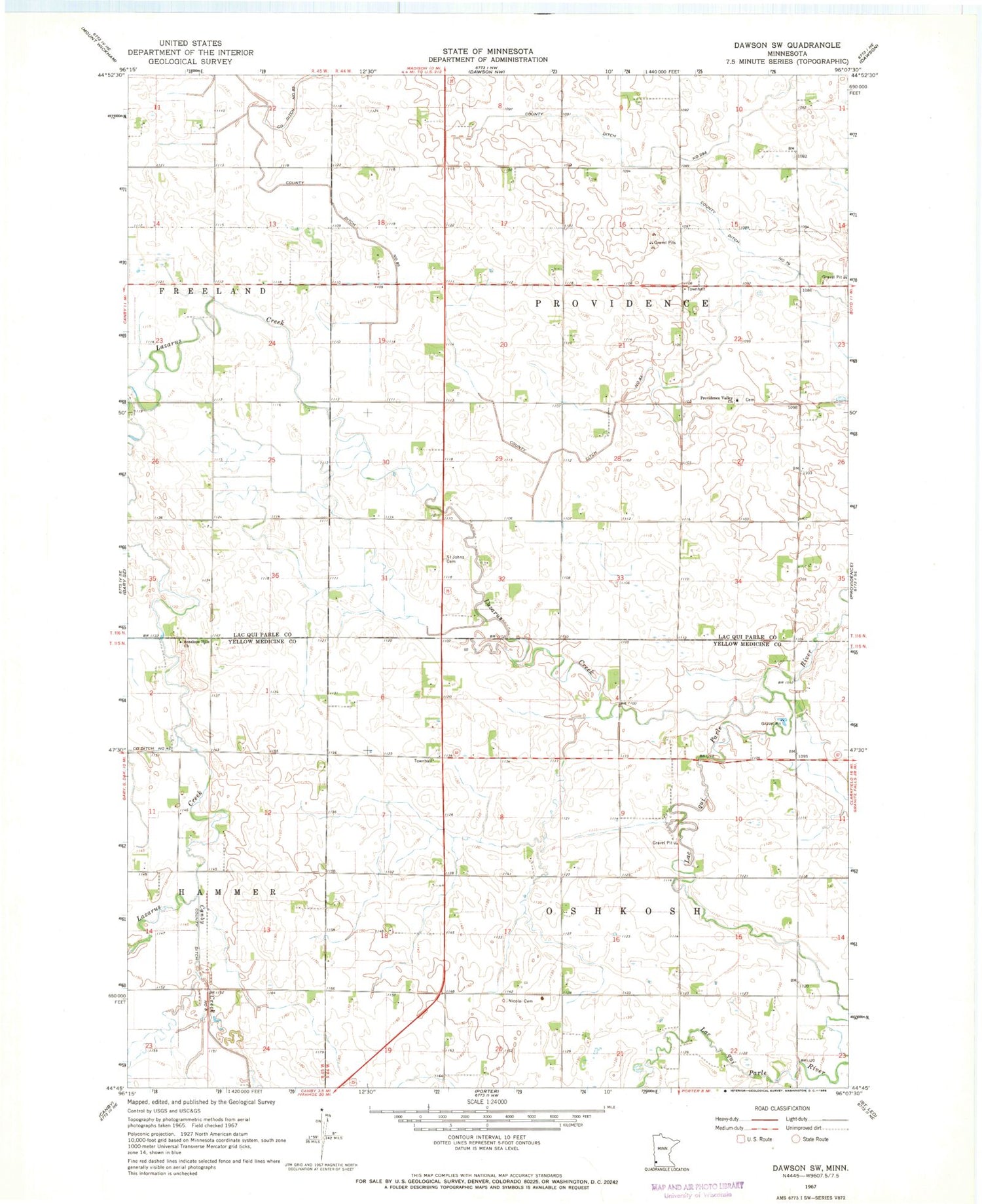
Classic USGS Dawson SW Minnesota 7.5'x7.5' Topo Map
Couldn't load pickup availability
Historical USGS topographic quad map of Dawson SW in the state of Minnesota. Map scale may vary for some years, but is generally around 1:24,000. Print size is approximately 24" x 27"
This quadrangle is in the following counties: Lac qui Parle, Yellow Medicine.
The map contains contour lines, roads, rivers, towns, and lakes. Printed on high-quality waterproof paper with UV fade-resistant inks, and shipped rolled.
Contains the following named places: Antelope Hills Christian Cemetery, Antelope Hills Church, Canby Creek, County Ditch Number Eightythree, County Ditch Number Seventynine, County Ditch Number Twentynine A, First Swedish Methodist Episcopal Cemetery, Lazarus Creek, Nicolai Cemetery, Providence Valley Cemetery, Providence Valley Church, Saint Johns Cemetery, Swedish Lutheran Cemetery, Township of Oshkosh, Township of Providence