MyTopo
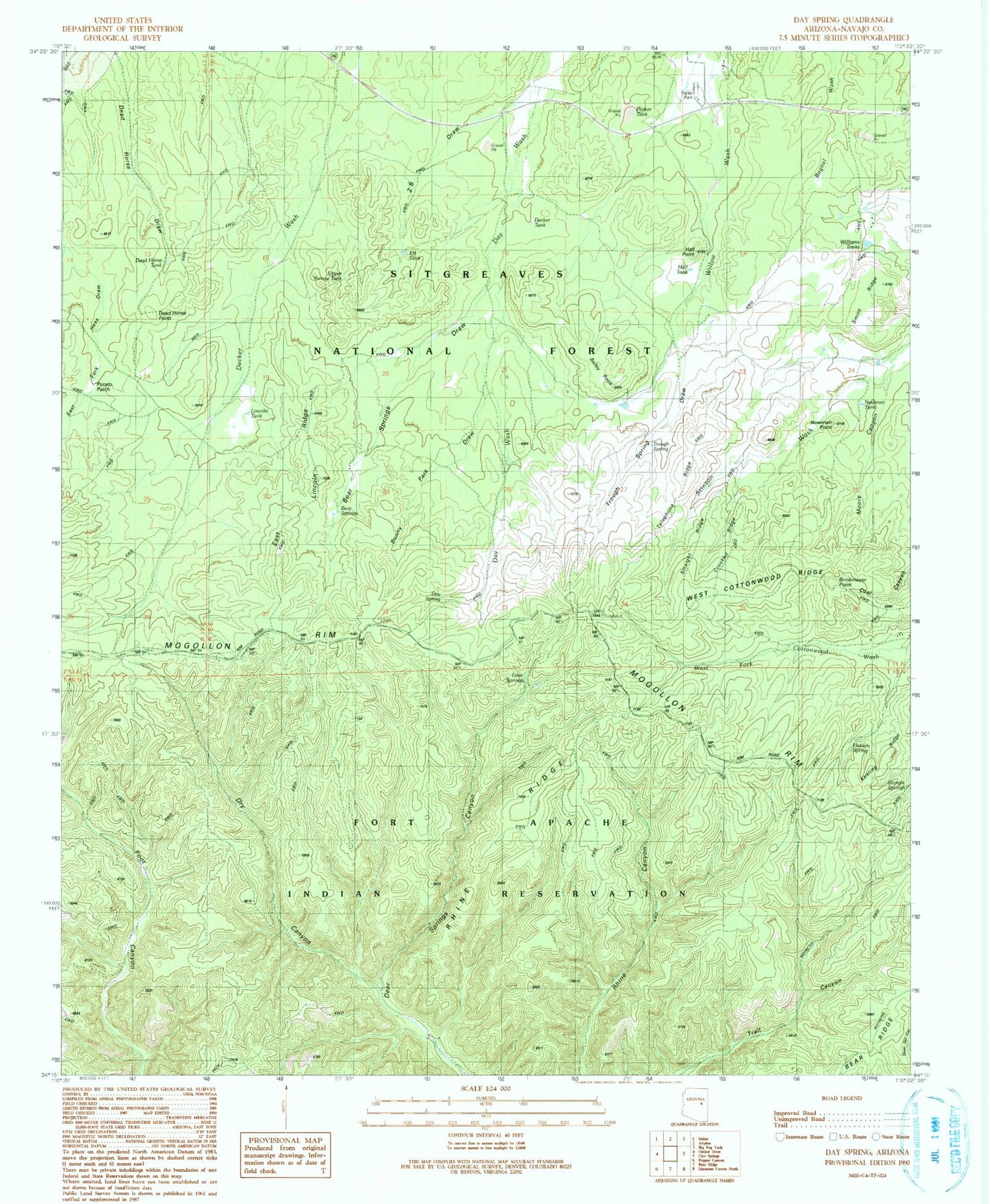
Classic USGS Day Spring Arizona 7.5'x7.5' Topo Map
Couldn't load pickup availability
Historical USGS topographic quad map of Day Spring in the state of Arizona. Typical map scale is 1:24,000, but may vary for certain years, if available. Print size: 24" x 27"
This quadrangle is in the following counties: Navajo.
The map contains contour lines, roads, rivers, towns, and lakes. Printed on high-quality waterproof paper with UV fade-resistant inks, and shipped rolled.
Contains the following named places: Deer Spring, Parker Tank, Bailey Tank, Bailey Point, Bear Springs, Bear Springs Draw, Brinkmeyer Point, Crooked Ridge, Day Spring, Dead Horse Point, Dead Horse Tank, Decker Tank, Deer Springs Guard Station, Dry Canyon, East Fork Hess Draw, East Lincoln Ridge, Hall Point, Hall Tank, Hidden Spring, Keating Ridge, Lincoln Tank, Moore Canyon, Newman Point, Newman Tank, Potato Patch, Shingle Spring, Smith Ridge, Straight Ridge, Sunny Park Draw, Telephone Ridge, Trough Spring, Trough Spring Draw, Upper Yarrow Tank, West Cottonwood Ridge, West Lincoln Trail, Williams Tanks, Z B Draw, Z B Tank, Bailey Tank, Bear Tank, Parker Number One Tank, Rhine Ridge, Tran Tank, Aripine Post Office, Deer Springs Lookout, Aztec Tank, East Fork Hess Tank, Lower Yarrow Tank, Phelps Tank, Bear Springs