MyTopo
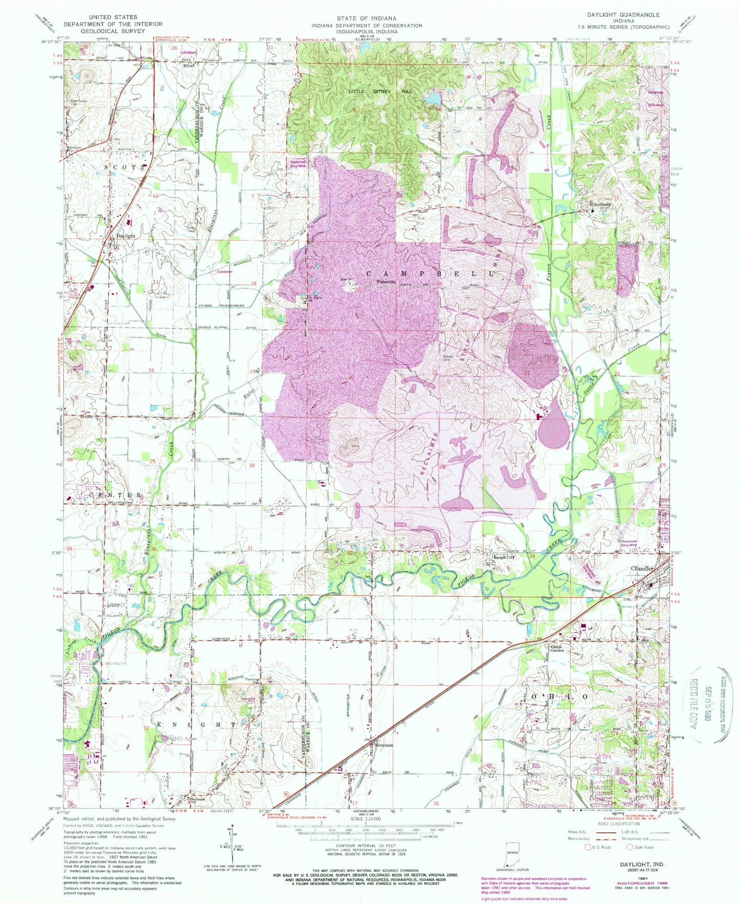
Classic USGS Daylight Indiana 7.5'x7.5' Topo Map
Couldn't load pickup availability
Historical USGS topographic quad map of Daylight in the state of Indiana. Map scale may vary for some years, but is generally around 1:24,000. Print size is approximately 24" x 27"
This quadrangle is in the following counties: Vanderburgh, Warrick.
The map contains contour lines, roads, rivers, towns, and lakes. Printed on high-quality waterproof paper with UV fade-resistant inks, and shipped rolled.
Contains the following named places: Angel Ditch, Asbury Cemetery, Barnes Ditch, Baugh City, Blue Grass Church, Blue Grass Church Cemetery, Bluegrass Creek, Boesche Ditch, Brinkmeyer Ditch, Burkhardt School, Castle Garden, Crawford Brandeis Ditch, Daylight, Dennis Klippel Ditch, Dennis Wagner Ditch, Elliott, Euler Branch, Fehd Ditch, Firlick Creek, Fisherville, Gardner Webb Ditch, Hansen Ditch, Howard Ditch, Knight Township Fire Department Company 6, Licking Creek, Little Ditney Hill, Millersburg, Ohio Township Fire Department Station 1, Perdido Lake, Raceway Airport, Saint John, Saint Johns Church, Schlensker Ditch, Scott Township Fire Department Station 2, Squaw Creek, Stevenson, Stollberg Ditch, Stubbs Fruedenberg Ditch, Township of Campbell, Weinsheimer Ditch, Woods Ditch, Zoar Church, ZIP Code: 47610