MyTopo
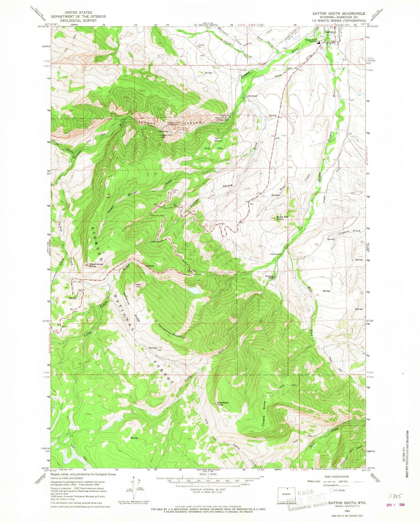
Classic USGS Dayton South Wyoming 7.5'x7.5' Topo Map
Couldn't load pickup availability
Historical USGS topographic quad map of Dayton South in the state of Wyoming. Typical map scale is 1:24,000, but may vary for certain years, if available. Print size: 24" x 27"
This quadrangle is in the following counties: Sheridan.
The map contains contour lines, roads, rivers, towns, and lakes. Printed on high-quality waterproof paper with UV fade-resistant inks, and shipped rolled.
Contains the following named places: Bulls Eye Point, Crystal Spring Draw, Deer Park, East Fork Little Tongue River, Elephant Foot, Fallen City, Hairpin Turn, Herdrick Ridge, Horseshoe Mountain, Horseshoe Ranch, I X L Ranch, Mock Gulch, Sand Turn, Steam Shovel Draw, Steamboat Point, Tongue Butte, Tongue Canyon, Tongue Canyon Campground, Tongue River Campground, Tongue River High School, Trail Creek, Turkey Creek, Amsden Creek, Pasture Creek, Sheep Creek, South Fork Little Tongue River, Whitetail Creek, South Side Ditch, Frisbie Ditch, Sheridan County Big Game Winter Range, Needles Eye, Big Horn Mountain Mine, Model Geyser, Town of Dayton, Xingu Airstrip, Dayton Volunteer Fire and Rescue Department, Dayton Cemetery