MyTopo
Classic USGS Dayton Oregon 7.5'x7.5' Topo Map
Couldn't load pickup availability
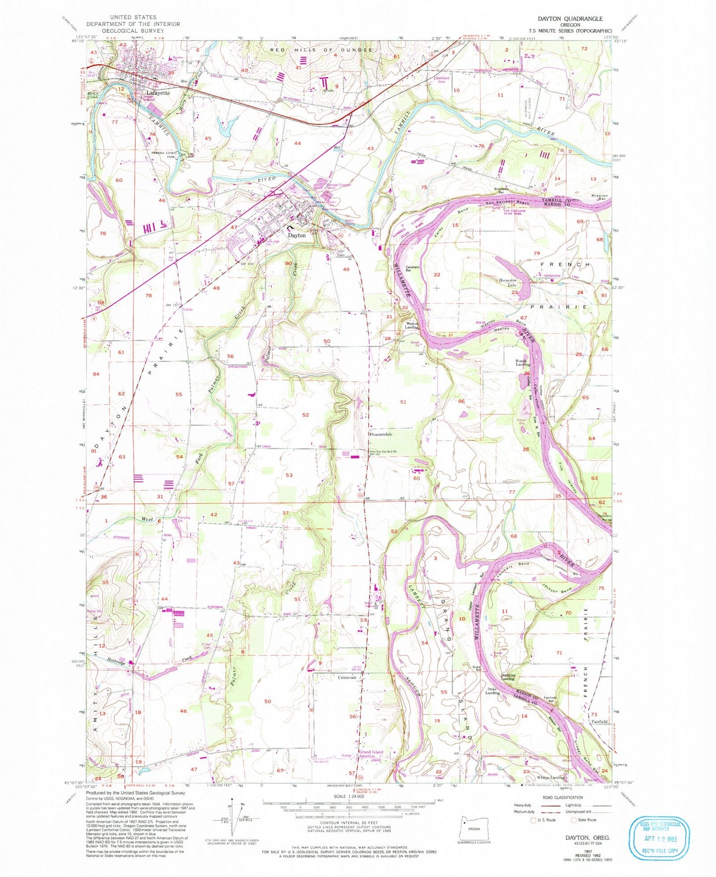
Historical USGS topographic quad map of Dayton in the state of Oregon. Map scale may vary for some years, but is generally around 1:24,000. Print size is approximately 24" x 27"
This quadrangle is in the following counties: Marion, Yamhill.
The map contains contour lines, roads, rivers, towns, and lakes. Printed on high-quality waterproof paper with UV fade-resistant inks, and shipped rolled.
Contains the following named places: 11th Street Park, 97114, 97127, Alderman Park, Allison Bar, Bible Baptist Church, Brentano Bar, Brookside Cemetery, Candiani Bar, Carey Bend, Church of Jesus Christ of Latter Day Saints, City of Dayton, City of Lafayette, Coffee Chute, Coffee Island, Coffee Island Bar, Cole and Forrester Dam, Commons Park, Connor Lake, Courthouse Square Park, Crawford, Crawford Post Office, Dayton, Dayton Boat Landing, Dayton City Hall, Dayton Fire District, Dayton Grade School, Dayton High School, Dayton Junior High School, Dayton Landing County Park, Dayton Municipal Courthouse, Dayton Post Office, Dayton Public Works, Dayton Sewage Treatment Lagoons, Dayton Station, Dayton Water Treatment Plant, Duke Bar, Duke Landing, Durettes Landing, Evers Lake, Fairfield, Fairfield Bar, Fairfield Post Office, Feasters Rocks, Five Islands, Five Islands Bar, Fort Yamhill State Park, Four Corners, Grand Island, Grand Island Junction, Grand Island School, Hawn Creek, Henry Creek, Historic Lafayette Research Library and Museum, Holdridge Creek, Horseshoe Lake, Independent Order of Odd Fellows Cemetery, Jackson Bend, Joel Perkins Park, Kunz Reservoir, Lafayette, Lafayette Airstrip, Lafayette City Hall, Lafayette Community Church, Lafayette Fire Department, Lafayette Locks County Park, Lafayette Municipal Courthouse, Lafayette Post Office, Lafayette Public Works, Lafayette Sewage Treatment Plant, Lambert Bend, Lambert Slough, Legion Field, Lippin Cotts Gulch, Lower Lambert Bar, Mary Gilkey City Public Library, Meadowbrook Lake, Michael Reservoir, Miller Creek, Millican Creek, Mission Bar, Mount Hood Post Office, Oaklawn, O'Dell Cemetery, Palmer Creek, Pioneer Evangelical Church, Pleasantdale, Riverwood Golf Course, Saint Clair Post Office, San Salvador Access, San Salvador Access Boat Ramp, San Salvador Beach, Schuetze Reservoir, Scottys Pond, Snaggy Bend Bar, Stockhoff Reservoir, Stringer Dam, Stringer Reservoir, Terry Park, Unionvale, Upper Lambert Bar, Warner Creek, Wascher Elementary School, Webfoot Grange Hall, West Fork Palmer Creek, Weston, Weston Bar, Weston Bend, Weston Landing, Whites Landing, Willamette Post Office, Woods Landing, Woods Reservoir