MyTopo
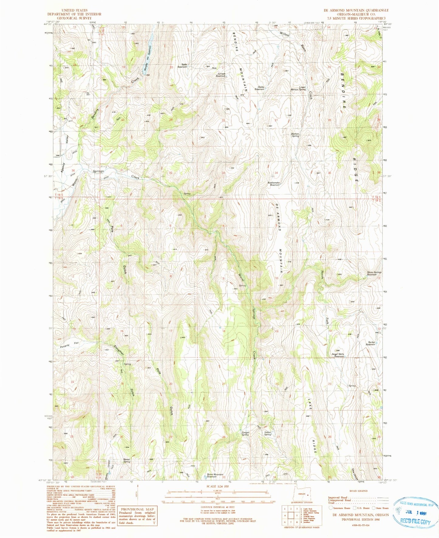
Classic USGS De Armond Mountain Oregon 7.5'x7.5' Topo Map
Couldn't load pickup availability
Historical USGS topographic quad map of De Armond Mountain in the state of Oregon. Map scale may vary for some years, but is generally around 1:24,000. Print size is approximately 24" x 27"
This quadrangle is in the following counties: Malheur.
The map contains contour lines, roads, rivers, towns, and lakes. Printed on high-quality waterproof paper with UV fade-resistant inks, and shipped rolled.
Contains the following named places: Angel Wells Reservoir, Baker Spring, Barrel Spring, Becker Reservoir, Bendire Creek, Bendire Mountain, Bendire Ridge, Big Flat, Big Flat Spring, Burnt Mountain Reservoir, De Armond Mountain, Goldy Reservoir, Indian Spring, Juniper Reservoir, Juniper Spring, Lower Morton Spring, Morton Spring, Munkers Ranch, Munkers Spring, Murphy Dam, Murphy Reservoir, North Fork Warm Springs Creek, Pole Gulch, Poverty Flat, Poverty Flat Spring, Rattlesnake Reservoir, Rattlesnake Spring, Rodeo Spring, Slaughter Gulch, Table Reservoir, Warm Springs Reservoir