MyTopo
Classic USGS De Bord Peaks Oregon 7.5'x7.5' Topo Map
Regular price
$16.95
Regular price
Sale price
$16.95
Unit price
per
Couldn't load pickup availability
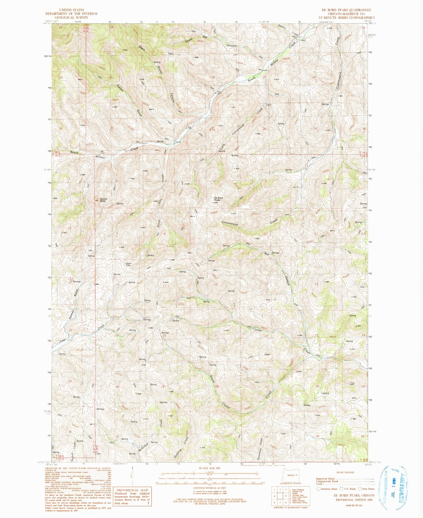
Historical USGS topographic quad map of De Bord Peaks in the state of Oregon. Map scale may vary for some years, but is generally around 1:24,000. Print size is approximately 24" x 27"
This quadrangle is in the following counties: Malheur.
The map contains contour lines, roads, rivers, towns, and lakes. Printed on high-quality waterproof paper with UV fade-resistant inks, and shipped rolled.
Contains the following named places: Black Stump Canyon, Cannon Gulch, De Bord Peaks, Dutch John Cabin, Dutch John Creek, Dutch John Section, Little Cottonwood Creek, Rail Canyon, Sheep Dip Canyon, South Clover Creek, Station Creek, Taxspa Butte, Timber Gulch