MyTopo
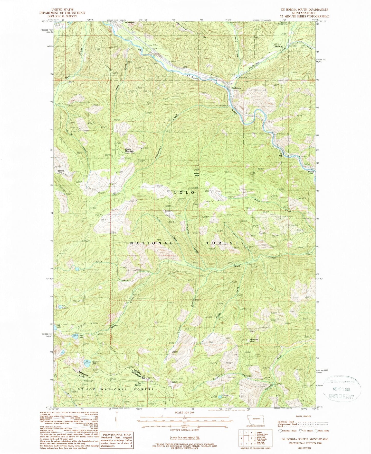
Classic USGS De Borgia South Montana 7.5'x7.5' Topo Map
Couldn't load pickup availability
Historical USGS topographic quad map of De Borgia South in the states of Montana, Idaho. Map scale may vary for some years, but is generally around 1:24,000. Print size is approximately 24" x 27"
This quadrangle is in the following counties: Mineral, Shoshone.
The map contains contour lines, roads, rivers, towns, and lakes. Printed on high-quality waterproof paper with UV fade-resistant inks, and shipped rolled.
Contains the following named places: Aladdin Mine, Armada, Armada School, Bed Springs, Cabin City, Canyon Creek, Cedar Creek, Coyle Creek, De Borgia Cemetery, De Borgia Census Designated Place, Drexel, Drexel Post Office, Drexel School, East Fork Twelvemile Creek, Fisher Creek, Gold Creek, Goldberg/Tawney Mine, Hazel Lake, Henderson, Henderson Creek, Henderson Hill, Henderson Post Office, Henderson School, Lenora Lake, Mann, Mayo Creek, Moon Peak, New Lanore Mine, New Lenore Mine, Newman Creek, Newman Peak, Rock Creek, Square Lake, Twelve Mile Creek Bridge, Twelvemile Creek, Twin Creek, Unnamed Creek, Up Up Mountain, West End Division, West Twin Creek