MyTopo
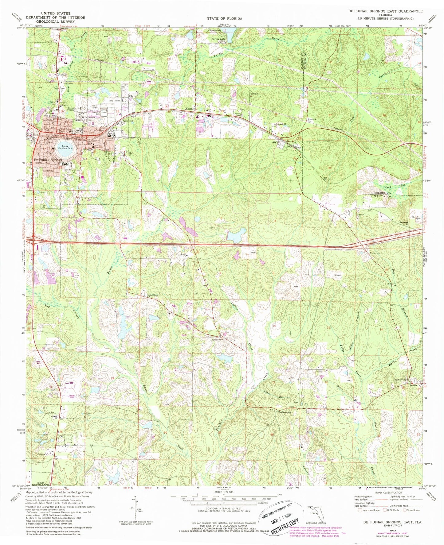
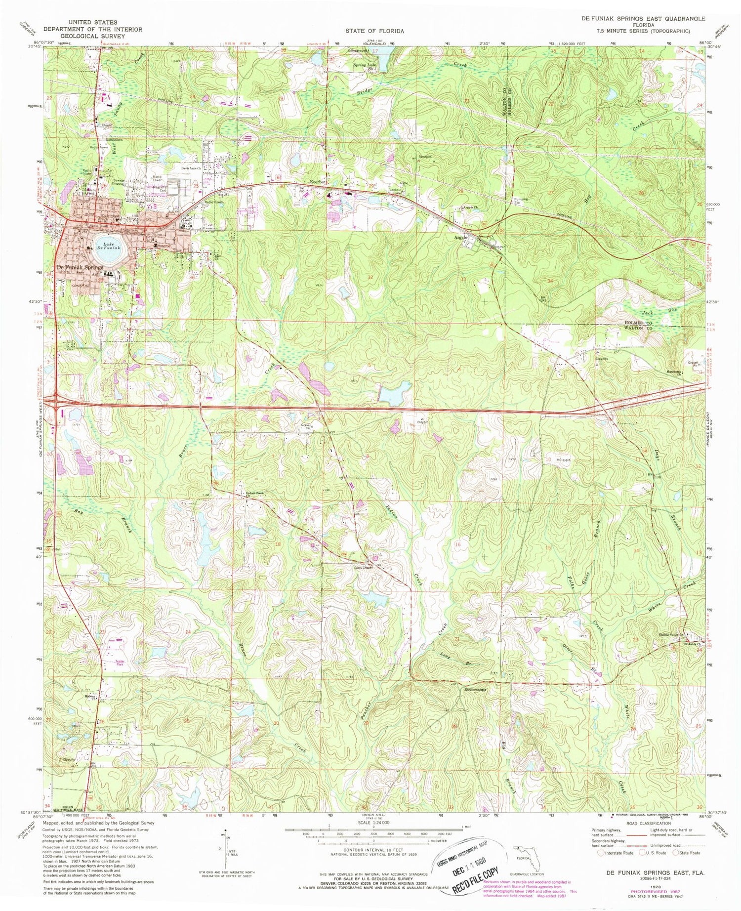
Classic USGS De Funiak Springs East Florida 7.5'x7.5' Topo Map
Couldn't load pickup availability
Historical USGS topographic quad map of De Funiak Springs East in the state of Florida. Map scale may vary for some years, but is generally around 1:24,000. Print size is approximately 24" x 27"
This quadrangle is in the following counties: Holmes, Walton.
The map contains contour lines, roads, rivers, towns, and lakes. Printed on high-quality waterproof paper with UV fade-resistant inks, and shipped rolled.
Contains the following named places: Argyle, Argyle Church, Argyle Fire Department, Argyle Post Office, Bay Branch, C J King Junior Pond, City of De Funiak Springs, Cuchens Airport, Davis Lane Church, Days Branch, De Funiak Springs, DeFuniak Springs Fire Department, DeFuniak Springs Police Department, DeFuniak Square, Euchee Valley Church, Eucheeanna, Folks Creek, Gillis Chapel, Goose Branch, Healthmark Regional Medical Center, Indian Creek, Indian Creek Church, Jack Bay, Koerber, Lake DeFuniak, Long Branch, Otter Branch, Panther Creek, S D Ingram Pond One, S D Ingram Pond Two, Saint Johns Church, Turner Farms Airport, Walcan, Walton County Fire Rescue Station 2 United Emergency Medical Services, Walton County Fire Rescue Station 4, Walton County Vocational Technical School, Walton Middle School, WGTX-AM (De Funiak Springs), WQUH-FM (De Funiak Springs), WZEP-AM (De Funiak Springs)