MyTopo
Classic USGS De Gray Arkansas 7.5'x7.5' Topo Map
Couldn't load pickup availability
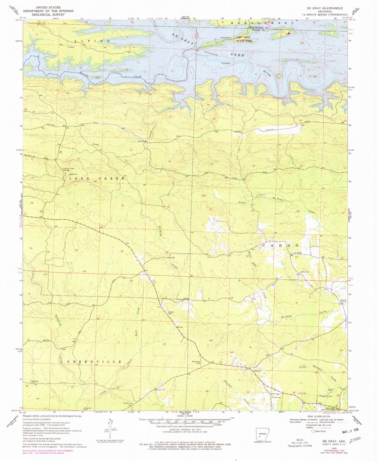
Historical USGS topographic quad map of De Gray in the state of Arkansas. Map scale may vary for some years, but is generally around 1:24,000. Print size is approximately 24" x 27"
This quadrangle is in the following counties: Clark, Hot Spring.
The map contains contour lines, roads, rivers, towns, and lakes. Printed on high-quality waterproof paper with UV fade-resistant inks, and shipped rolled.
Contains the following named places: Brushy Creek, Buck Creek, Callaway Cemetery, De Gray, De Gray State Park, DeGray Baptist Church, Degray Rural Volunteer Fire Station, Golden Cemetery, Hart Cemetery, Hearn, Hearn Church, Iron Mountain Recreation Area, Little Creek, Long Creek, Mount Olive Baptist Church, New Hope Cemetery, Ozan Point Recreation Area, Shady Grove Church, Township of Long Creek, White Oak Creek, Wingfield Cemetery