MyTopo
Classic USGS De Motte Park Arizona 7.5'x7.5' Topo Map
Couldn't load pickup availability
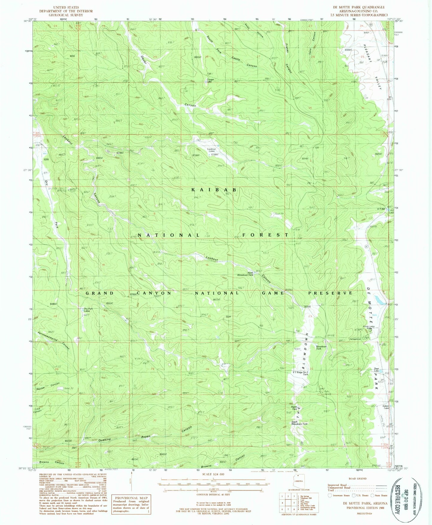
Historical USGS topographic quad map of De Motte Park in the state of Arizona. Typical map scale is 1:24,000, but may vary for certain years, if available. Print size: 24" x 27"
This quadrangle is in the following counties: Coconino.
The map contains contour lines, roads, rivers, towns, and lakes. Printed on high-quality waterproof paper with UV fade-resistant inks, and shipped rolled.
Contains the following named places: Cougar Lake, De Motte Park, Dry Park, Dry Park Lakes, Dry Park Lookout, Indian Lake, Kaibab Lodge, Lookout Lakes, V T Hill, V T Lake, West Blow Down Tank, DeMotte Campground, North Blow Down Tank, South Blow Down Tank, V T Park Landing Strip (historical), V T Ridge Number One Tank, V T Ridge Number Two Tank, Blowdown Tank, The Blowdown, Aspen Tank, Deer Lake, Dry Park Apron, Browns Canyon Tank