MyTopo
Classic USGS De Queen NW Arkansas 7.5'x7.5' Topo Map
Regular price
$16.95
Regular price
Sale price
$16.95
Unit price
per
Couldn't load pickup availability
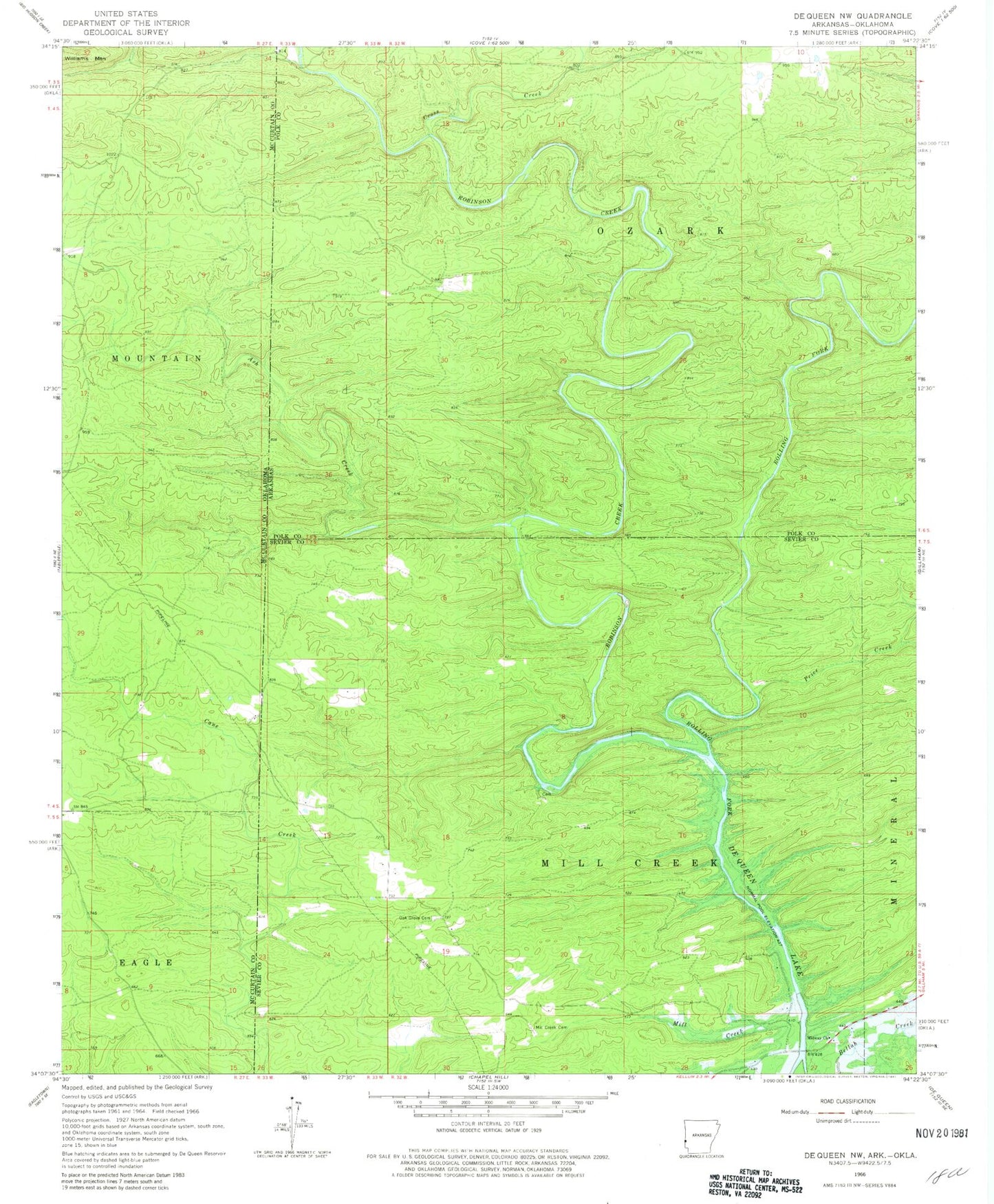
Historical USGS topographic quad map of De Queen NW in the states of Arkansas, Oklahoma. Map scale may vary for some years, but is generally around 1:24,000. Print size is approximately 24" x 27"
This quadrangle is in the following counties: McCurtain, Polk, Sevier.
The map contains contour lines, roads, rivers, towns, and lakes. Printed on high-quality waterproof paper with UV fade-resistant inks, and shipped rolled.
Contains the following named places: Ash Creek, Blanchard, Cross Creek, Independence School, Midway Church, Mill Creek, Mill Creek Cemetery, Mill Creek School, Oak Grove Cemetery, Price Creek, Redding School, Robinson Creek, Shady Grove School, Township of Mill Creek