MyTopo
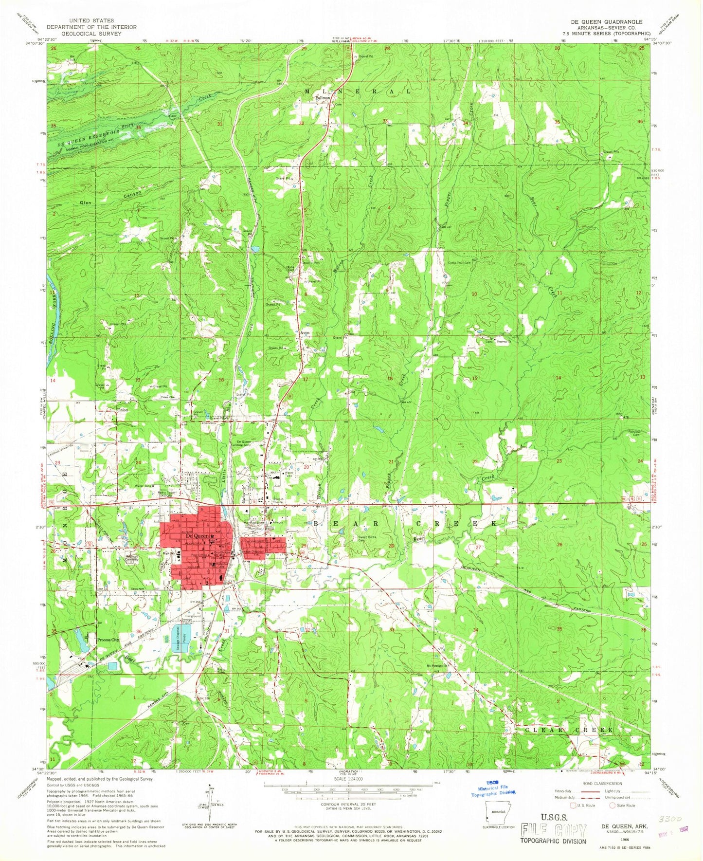
Classic USGS De Queen Arkansas 7.5'x7.5' Topo Map
Couldn't load pickup availability
Historical USGS topographic quad map of De Queen in the state of Arkansas. Map scale may vary for some years, but is generally around 1:24,000. Print size is approximately 24" x 27"
This quadrangle is in the following counties: Sevier.
The map contains contour lines, roads, rivers, towns, and lakes. Printed on high-quality waterproof paper with UV fade-resistant inks, and shipped rolled.
Contains the following named places: Avon, Avon Cemetery, Avon School, Baker School, Center Grove School, Christian Home Church, City of De Queen, Community Hospital of De Queen Heliport, Cross Trail School, Cross Trails, Cross Trails Cemetery, De Queen, De Queen Medical Center, De Queen Elementary School, De Queen Fire Station, De Queen High School, De Queen Landing Strip, De Queen Manor Nursing Home, De Queen Middle School, De Queen Police Department, De Queen Post Office, DeQueen Primary School, Fairview Cemetery, Fairview Church, Herman Direk Memorial Park, KDQN-AM (De Queen), KDQN-FM (De Queen), Lifenet Incorporated - De Queen (Ambulance Services), Little Bear Creek, Mount Pleasant Church, Mount Pleasant School, Pepper Creek, Piney Grove School, Process City, Process City Lake, Process City Lake Dam, Pullman, Pullman Methodist Church, Pullman School, Redmen Cemetery, Ridgeview Lodge Nursing Home, Sevier County Courthouse, Sevier County Sheriff's Office, Smyrna Cemetery, Smyrna Church of Christ, South Central Arkansas Drug Task Force, Southwest Emergency Medical Service DeQueen, Sweet Home Cemetery, Town North Shopping Center, Township of Bear Creek, Union, Union Church, Union School, Wilson Creek, ZIP Code: 71832