
MyTopo
Classic USGS De Valls Bluff SE Arkansas 7.5'x7.5' Topo Map
Couldn't load pickup availability
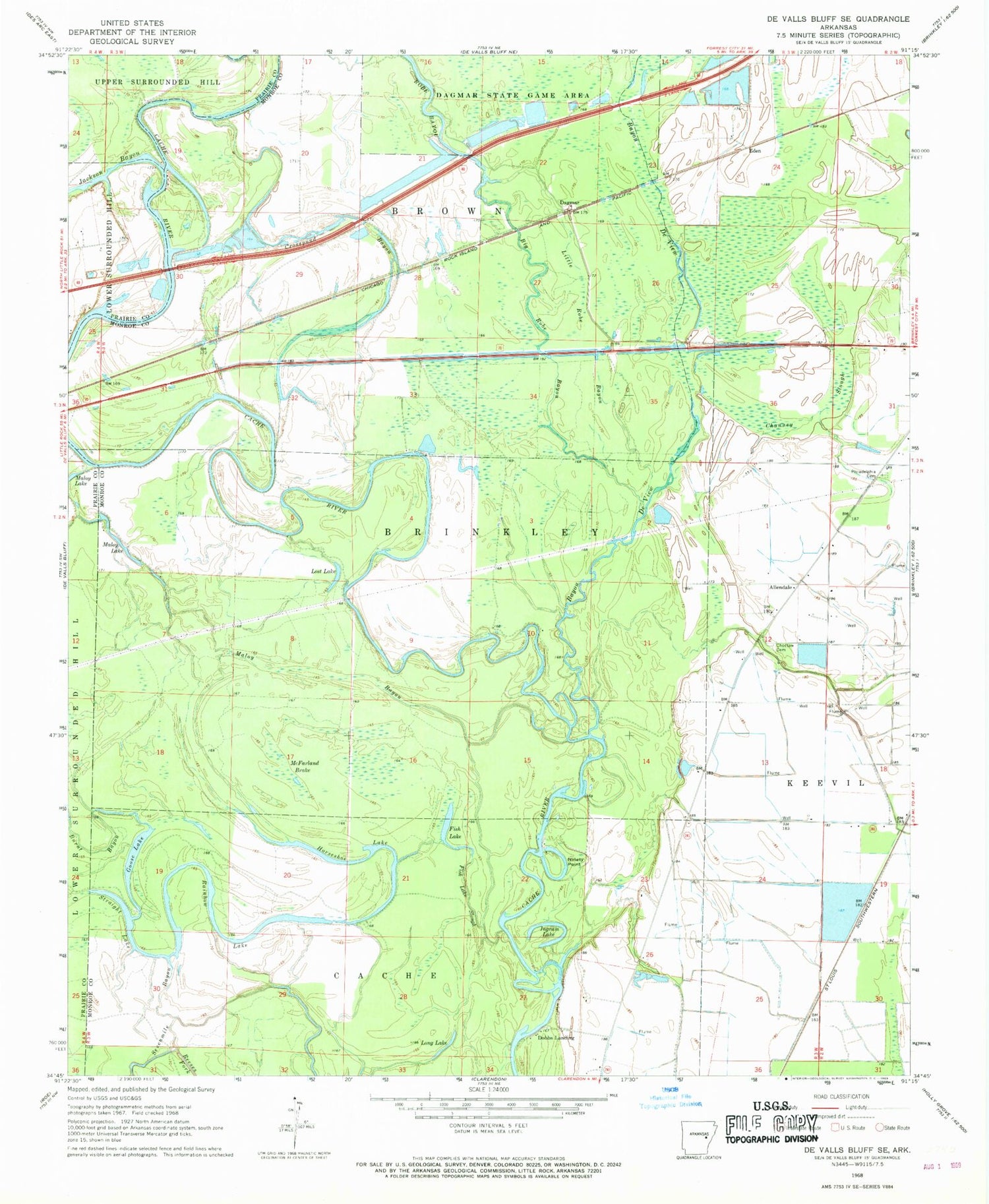
Historical USGS topographic quad map of De Valls Bluff SE in the state of Arkansas. Map scale may vary for some years, but is generally around 1:24,000. Print size is approximately 24" x 27"
This quadrangle is in the following counties: Monroe, Prairie.
The map contains contour lines, roads, rivers, towns, and lakes. Printed on high-quality waterproof paper with UV fade-resistant inks, and shipped rolled.
Contains the following named places: Allendale, Bayou De View, Big Robe Bayou, Channey Slough, Choctaw Cemetery, Crosspond Bayou, Dagmar, Dobbs Landing, Eden, Fish Lake, Fish Lake Slough, Goose Lake, Horseshoe Lake, Ingram Lake, Jackson Bayou, Jones Island, Little Robe Bayou, Long Lake, Lost Lake, Maloy Bayou, Maloy Lake, McFarland Brake, Ninety Point, Philadelphia Cemetery, Philadelphia Church, Rainbow Lake, Reeses Fork, Sevenmile Bayou, Straight Lake, Township of Brown


