MyTopo
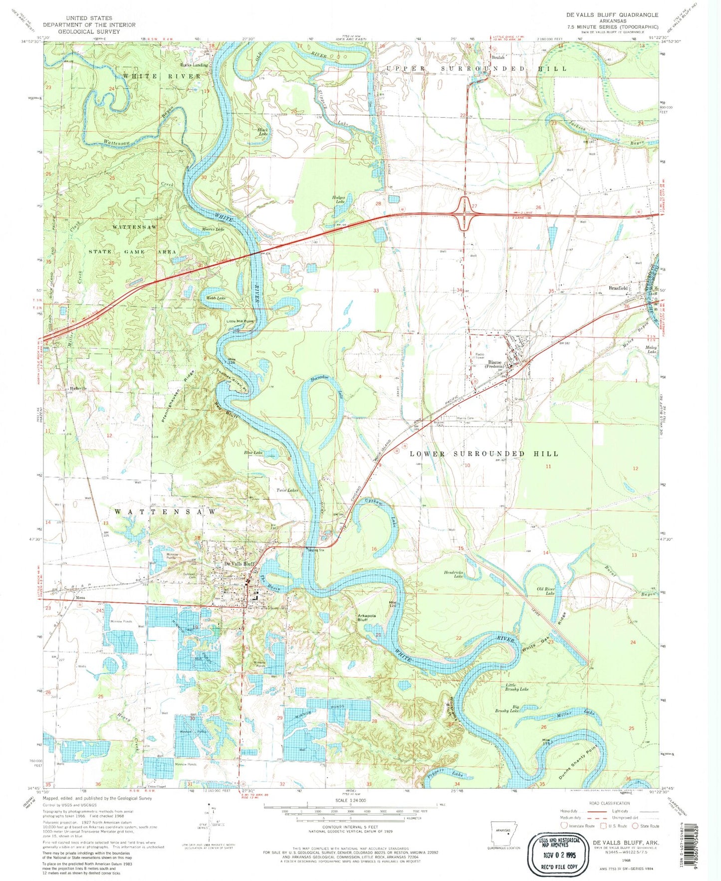
Classic USGS De Valls Bluff Arkansas 7.5'x7.5' Topo Map
Couldn't load pickup availability
Historical USGS topographic quad map of De Valls Bluff in the state of Arkansas. Map scale may vary for some years, but is generally around 1:24,000. Print size is approximately 24" x 27"
This quadrangle is in the following counties: Monroe, Prairie.
The map contains contour lines, roads, rivers, towns, and lakes. Printed on high-quality waterproof paper with UV fade-resistant inks, and shipped rolled.
Contains the following named places: Argo Reservoir, Argo Reservoir Dam, Arkapola Bluff, Berden Slough Bend, Beulah, Big Brushy Lake, Biscoe, Biscoe Cemetery, Biscoe Post Office, Biscoe Volunteer Fire Station, Black Lake, Blue Lake, Brasfield, Bucks Landing, Burnt Bayou, Catfish Lake, Catfish Lake Dam, City of De Valls Bluff, Clark Creek, Coles Bend, De Valls Bluff, De Valls Bluff First Baptist Church, De Valls Bluff Police Department, De Valls Bluff Post Office, De Valls Bluff Volunteer Fire Department, DeValls Bluff Elementary School, DeValls Bluff High School, Dunns Shanty Point, Fisher Landing, Frakers Reservoir, Hallsville, Harris Cemetery, Hendricks Lake, Hider Bend, Hodges Lake, Horseshoe Lake, Little Brushy Lake, Little Hill, Little Mill Point, Maloy Bayou, Mesa, Miers Lake, Miers Lake Dam, Miller Creek, Miller Lake, Moores Lake, Oakland Cemetery, Old River Lake, Pfennighausen Ridge, Pumps Bend, Slippery Lake, The Basin, Thomas Allen Point, Town of Fredonia (Biscoe), Township of Lower Surrounded Hill, Township of Watensaw, Twin Lakes, Union Chapel, Upshaw Lake, Wattensaw Bayou, Webb Lake, Webb Lake Bend, White Oak Ridge, White River Bridge, Worshams Bluff, Yuma