MyTopo
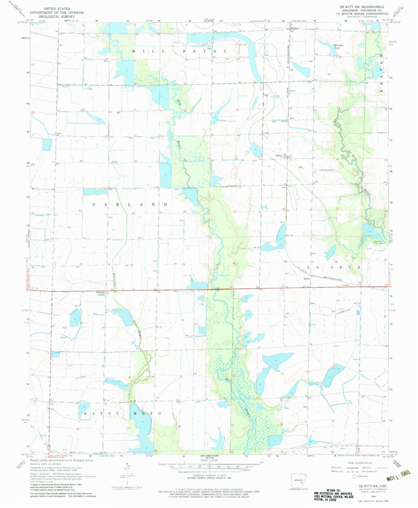
Classic USGS De Witt SW Arkansas 7.5'x7.5' Topo Map
Couldn't load pickup availability
Historical USGS topographic quad map of De Witt SW in the state of Arkansas. Map scale may vary for some years, but is generally around 1:24,000. Print size is approximately 24" x 27"
This quadrangle is in the following counties: Arkansas.
The map contains contour lines, roads, rivers, towns, and lakes. Printed on high-quality waterproof paper with UV fade-resistant inks, and shipped rolled.
Contains the following named places: Arkansas Noname 280 Dam, Burks, Ditch Number 1, Ditch Number 2, Eldridge Corner, Fullers Reservoir, Girerd Pond, Girerd Pond Dam, Hall Lake, Hall Lake Dam, Hillman Pond, Hillman Pond Dam, Hillman Reservoir Dam, Hillman Reservoir Number Two Dam, Kittlers, Lateral Number 10, Lateral Number 11, Lateral Number 12, Lateral Number 13, Lateral Number 5, Lateral Number 6, Lateral Number 9, Main Ditch, Monica, New Providence School, Olena, Sollars Reservoir, Sollars Reservoir Dam, Thomas Reservoir, Thomas Reservoir Dam, Thomas Reservoirs