MyTopo
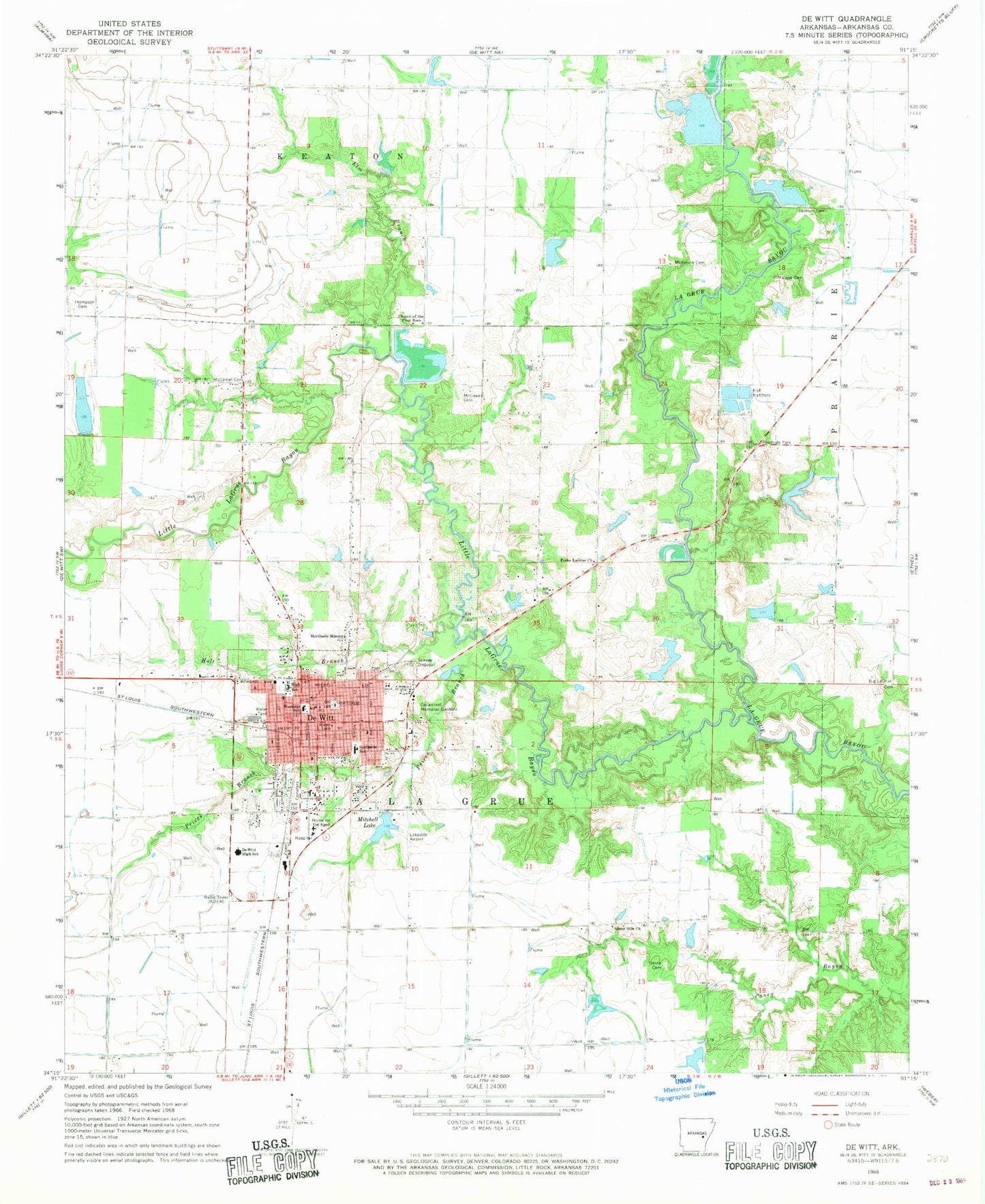
Classic USGS De Witt Arkansas 7.5'x7.5' Topo Map
Couldn't load pickup availability
Historical USGS topographic quad map of De Witt in the state of Arkansas. Map scale may vary for some years, but is generally around 1:24,000. Print size is approximately 24" x 27"
This quadrangle is in the following counties: Arkansas.
The map contains contour lines, roads, rivers, towns, and lakes. Printed on high-quality waterproof paper with UV fade-resistant inks, and shipped rolled.
Contains the following named places: Alter Lake, Alter Lake Dam, Alter Lake Number Two, Alter Lake Number Two Dam, Arkansas County, Arkansas County Courthouse, Arkansas County Sheriff's Office, Arkansas Noname 288 Dam, Big La Grue Cemetery, Cedarcrest Memorial Gardens, Center School, Church of the First Born, City of DeWitt, De Witt, De Witt Cemetery, De Witt City Hospital Heliport, De Witt City Nursing Home, De Witt Fire Station, De Witt High School, De Witt Middle School, De Witt Police Department, De Witt Public Library, Dewitt City Hospital, Dewitt High School, DeWitt Municipal Airport Whitcomb Field, DeWitt Post Office, Ditch Number 3, Elm Branch, First Christian Church, First United Methodist Church, Fork of LaGrue School, Forks La Grue Church, Forks LaGrue Cemetery, Gaines School, Hearn Cemetery, Holt Branch, Jackson Cemetery, KDEW-AM (De Witt), KDEW-FM (De Witt), Lakeside Airport, Little LaGrue Bayou, Malone Cemetery, McCowan Cemetery, McDaniel Cemetery, McKenzie Cemetery, McKewen Lake, McKewen Lake Dam, Miller Lake, Miller Lake Dam, Mitchell Lake, Mitchell Lake Dam, Morning Glory Cemetery, Northside Mission, Oakhills Country Club, Prices Branch, Ricebelt Vocational Technical School, Southside Elementary School, Sunny Side Church, Sunny Side School, Thompson Cemetery, Thomwall, Township of La Grue, Union Lake, Union Lake Dam, Westside Elementary School, ZIP Code: 72042