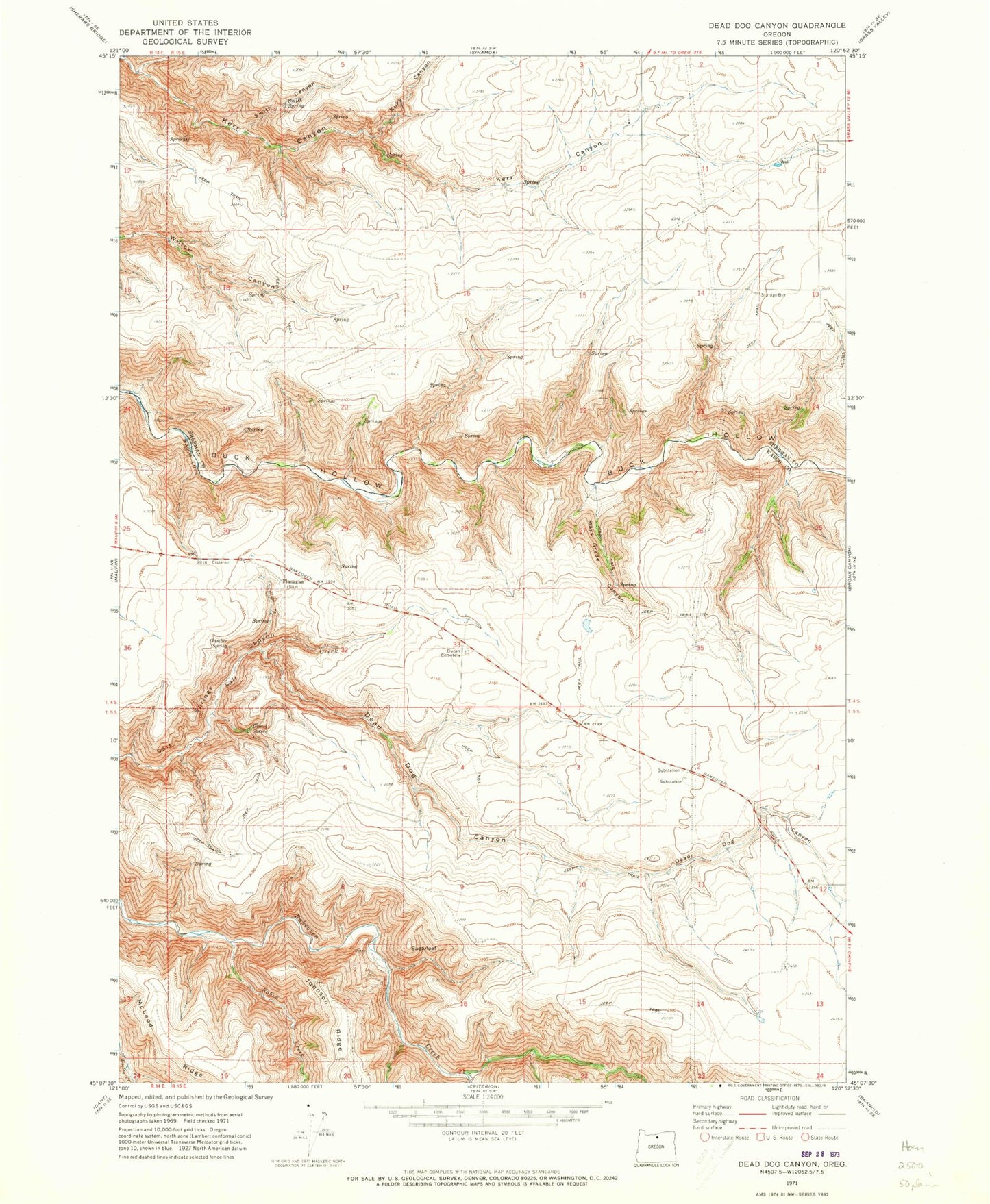
MyTopo
Classic USGS Dead Dog Canyon Oregon 7.5'x7.5' Topo Map
Regular price
$16.95
Regular price
Sale price
$16.95
Unit price
per
Couldn't load pickup availability
Historical USGS topographic quad map of Dead Dog Canyon in the state of Oregon. Map scale may vary for some years, but is generally around 1:24,000. Print size is approximately 24" x 27"
This quadrangle is in the following counties: Sherman, Wasco.
The map contains contour lines, roads, rivers, towns, and lakes. Printed on high-quality waterproof paper with UV fade-resistant inks, and shipped rolled.
Contains the following named places: Buzan Cemetery, Dead Dog Canyon, Deep Creek, Denny Spring, Flanagan, Flanagan Post Office, Gamber Spring, Kuks Canyon, Mays Grade Canyon, Robin Creek, Smith Canyon, Smith Spring, Sugarloaf