
MyTopo
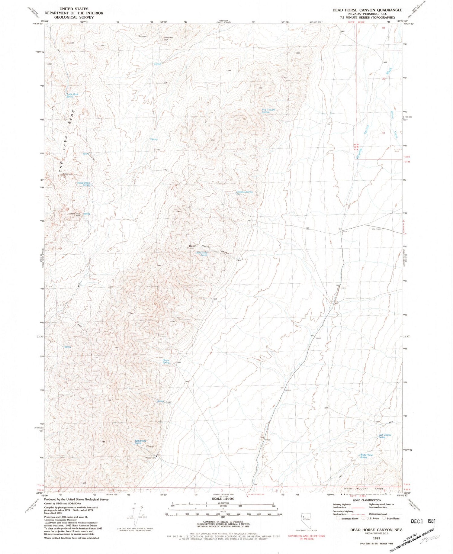
Classic USGS Dead Horse Canyon Nevada 7.5'x7.5' Topo Map
Couldn't load pickup availability
Historical USGS topographic quad map of Dead Horse Canyon in the state of Nevada. Map scale may vary for some years, but is generally around 1:24,000. Print size is approximately 24" x 27"
This quadrangle is in the following counties: Pershing.
The map contains contour lines, roads, rivers, towns, and lakes. Printed on high-quality waterproof paper with UV fade-resistant inks, and shipped rolled.
Contains the following named places: Dead Horse Canyon, Dead Horse Spring, Elephant Head Rock, Elephant Head Spring, Five Troughs Springs, Hanna Spring, Hannan Range, Hilltop Mine, Last Chance Spring, Nera Spring, Rattlesnake Spring, Rockhill Canyon, Scorpion Spring, Sheep Head Spring, Staggs Mining District, Tarantula Spring, Turtle Rock Spring, White Horse Spring, Willow Creek, Windy Hill Mine


