
MyTopo
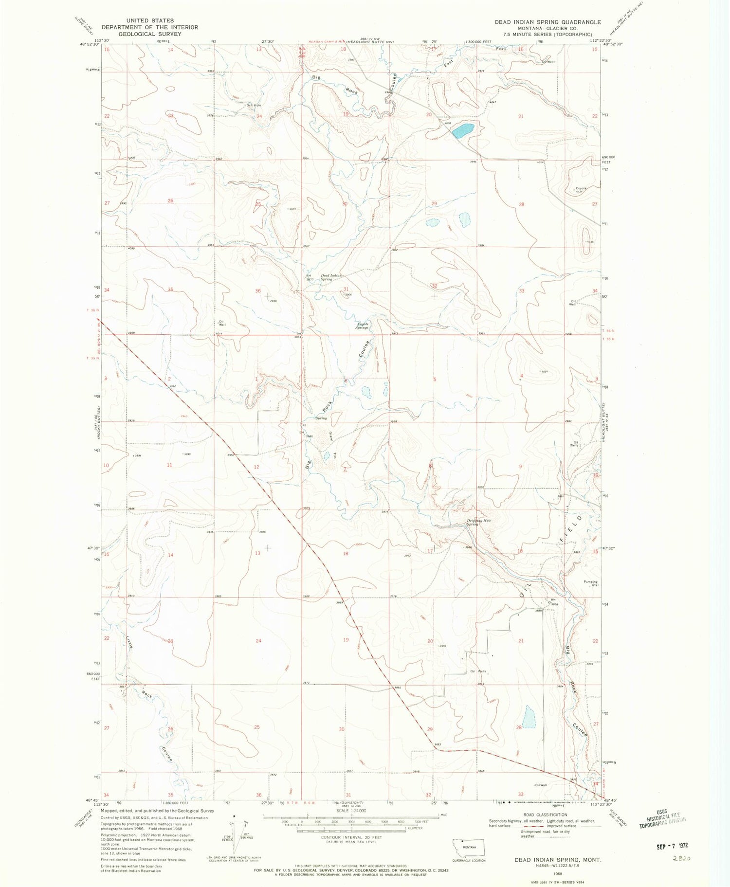
Classic USGS Dead Indian Spring Montana 7.5'x7.5' Topo Map
Regular price
$16.95
Regular price
Sale price
$16.95
Unit price
per
Couldn't load pickup availability
Historical USGS topographic quad map of Dead Indian Spring in the state of Montana. Map scale may vary for some years, but is generally around 1:24,000. Print size is approximately 24" x 27"
This quadrangle is in the following counties: Glacier.
The map contains contour lines, roads, rivers, towns, and lakes. Printed on high-quality waterproof paper with UV fade-resistant inks, and shipped rolled.
Contains the following named places: 35N06W10BC__01 Well, 35N06W15BD__01 Well, 35N06W21AB__01 Well, 35N06W21BC__01 Well, 35N06W21CB__01 Well, Coyote Springs, Dead Indian Spring, Dripping Hole Spring, East Fork Big Rock Coulee


