MyTopo
Classic USGS Deadhorse Ridge Oregon 7.5'x7.5' Topo Map
Couldn't load pickup availability
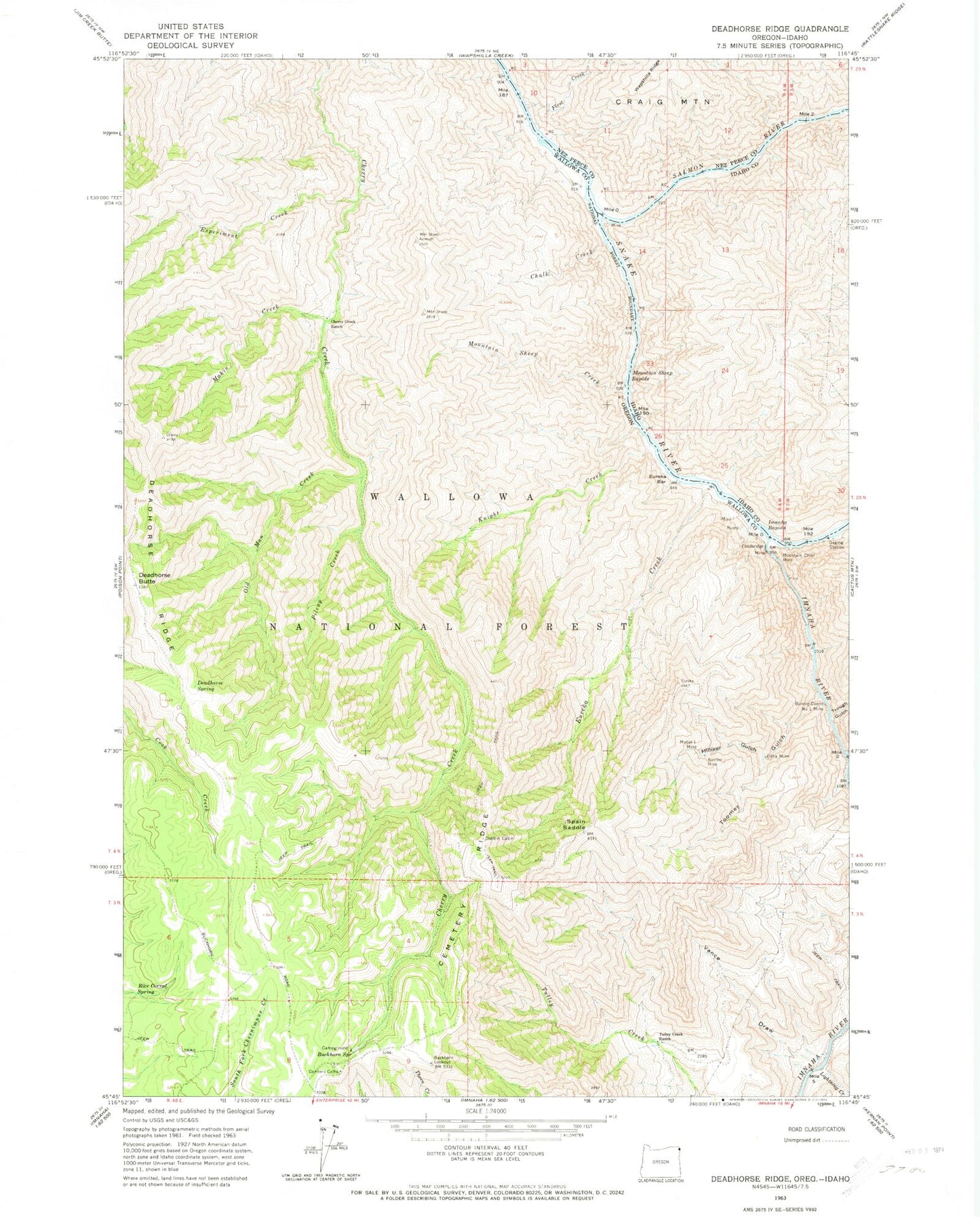
Historical USGS topographic quad map of Deadhorse Ridge in the states of Oregon, Idaho. Typical map scale is 1:24,000, but may vary for certain years, if available. Print size: 24" x 27"
This quadrangle is in the following counties: Idaho, Nez Perce, Wallowa.
The map contains contour lines, roads, rivers, towns, and lakes. Printed on high-quality waterproof paper with UV fade-resistant inks, and shipped rolled.
Contains the following named places: Bonnie Doone Number One Mine, Buckhorn Lookout, Buckhorn Spring, Cemetery Ridge, Chalk Creek, Cherry Creek Ranch, Cow Creek, Deadhorse Butte, Deadhorse Ridge, Deadhorse Spring, Dobbin Cabin, Edna Mine, Eureka Bar, Eureka Creek, Experiment Creek, Footbridge Mine, Hilliker Gulch, Imnaha River, Knight Creek, Lightning Creek, Mabel L Mine, Makin Creek, Mountain Chief Mine, Mountain Sheep Creek, Old Man Creek, Pileup Creek, Rustler Mine, Spain Saddle, Toomey Gulch, Trough Gulch, Tulley Creek Ranch, Vance Draw, Eureka (historical), Bear Creek Rapids, Eureka Creek Cabin, Buckhorn Recreation Site, Eureka Post Office (historical), Lightning Post Office (historical), Clemons Place, First Creek, Salmon River, Imnaha Rapids, Mountain Sheep Rapids