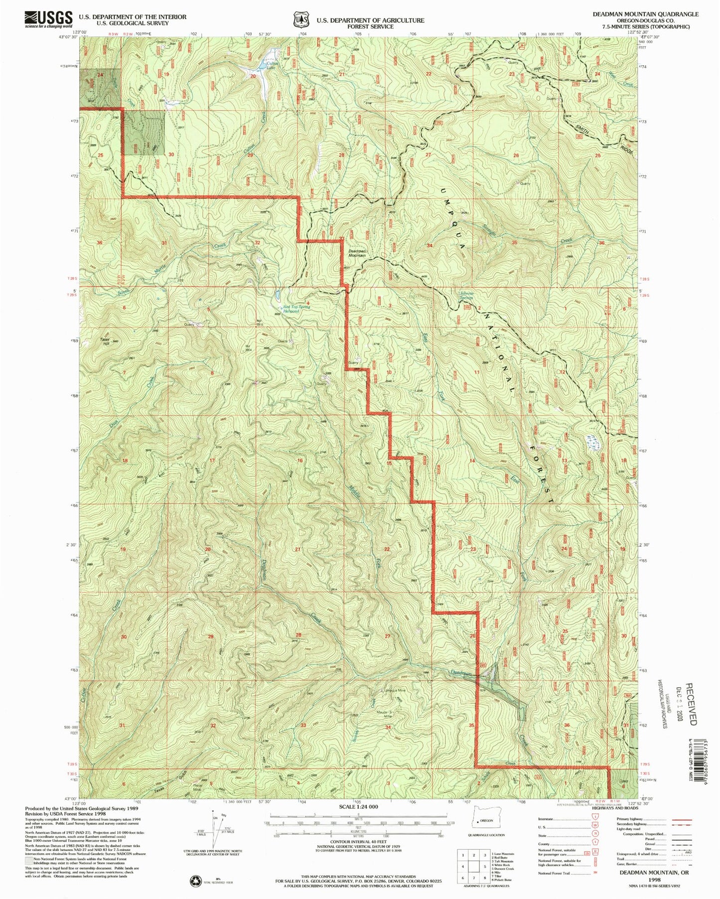
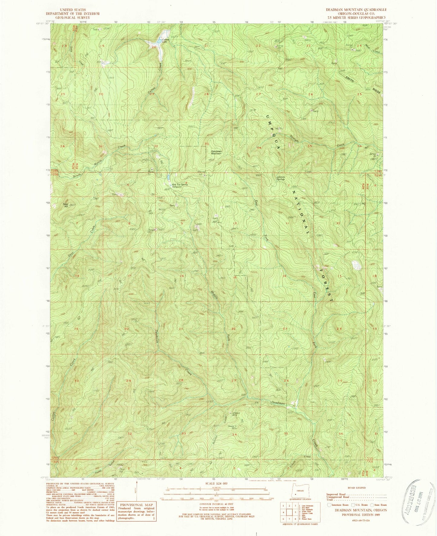
MyTopo
Classic USGS Deadman Mountain Oregon 7.5'x7.5' Topo Map
Couldn't load pickup availability
Historical USGS topographic quad map of Deadman Mountain in the state of Oregon. Map scale may vary for some years, but is generally around 1:24,000. Print size is approximately 24" x 27"
This quadrangle is in the following counties: Douglas.
The map contains contour lines, roads, rivers, towns, and lakes. Printed on high-quality waterproof paper with UV fade-resistant inks, and shipped rolled.
Contains the following named places: Cow Creek Reservation, Cultus Lake, Deadman Mountain, Deer Spring, East Fork Deadman Creek, Johnnie Springs, Maude- S Mine, Middle Fork Deadman Creek, Red Top Spring, Red Top Spring Helipond, Schulz Creek, Smith Ridge, Stanley Creek, Tater Hill, Umpqua Mine, Windy Camp, Windy Camp Lookout