MyTopo
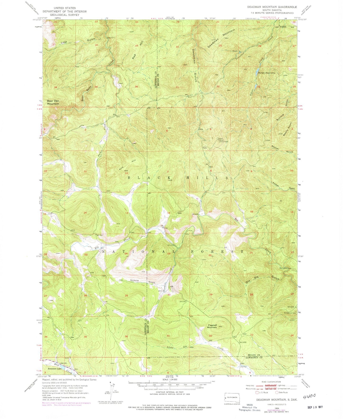
Classic USGS Deadman Mountain South Dakota 7.5'x7.5' Topo Map
Couldn't load pickup availability
Historical USGS topographic quad map of Deadman Mountain in the state of South Dakota. Typical map scale is 1:24,000, but may vary for certain years, if available. Print size: 24" x 27"
This quadrangle is in the following counties: Lawrence, Meade.
The map contains contour lines, roads, rivers, towns, and lakes. Printed on high-quality waterproof paper with UV fade-resistant inks, and shipped rolled.
Contains the following named places: Deadman Mountain, Dry Elk Gulch, Flagstaff Mountain, Kirk Hill, Lost Gulch, Meadow Creek, Park Creek, Reausaw Lake, Red Hill, Sturgis Reservoirs, Veteran Lookout Tower, Virkula Gulch, Bethlehem, KRCS-FM (Sturgis), Centennial Trail, Fort Meade Veterans Administration Watershed, Elk Creek (historical), Runkel (historical), Reausew (historical), Mowatt (historical), Germania (historical), Two Bit Mine (historical), Anthonys (historical), Apex (historical), Bear Butte (historical)