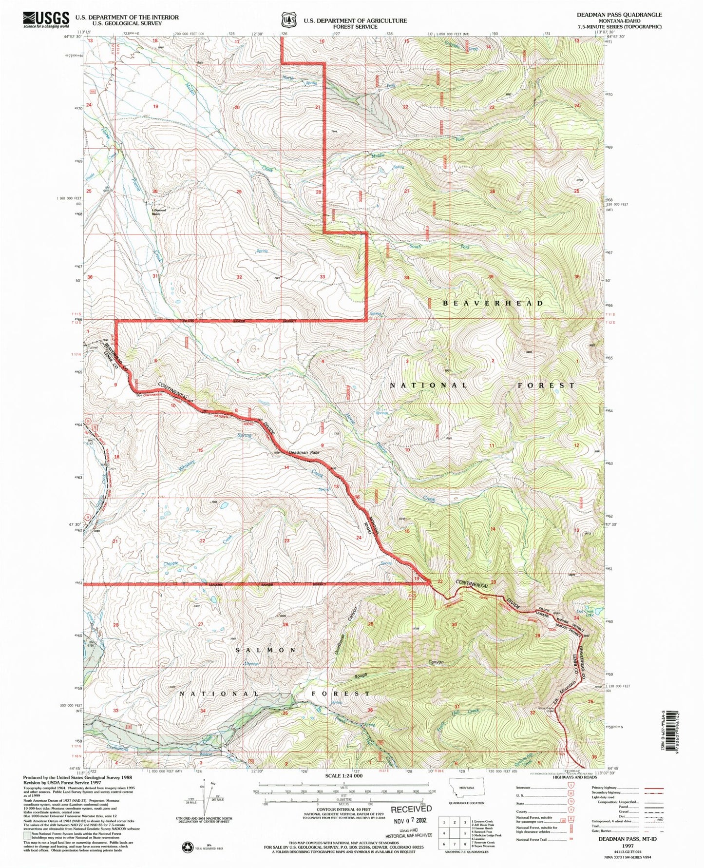
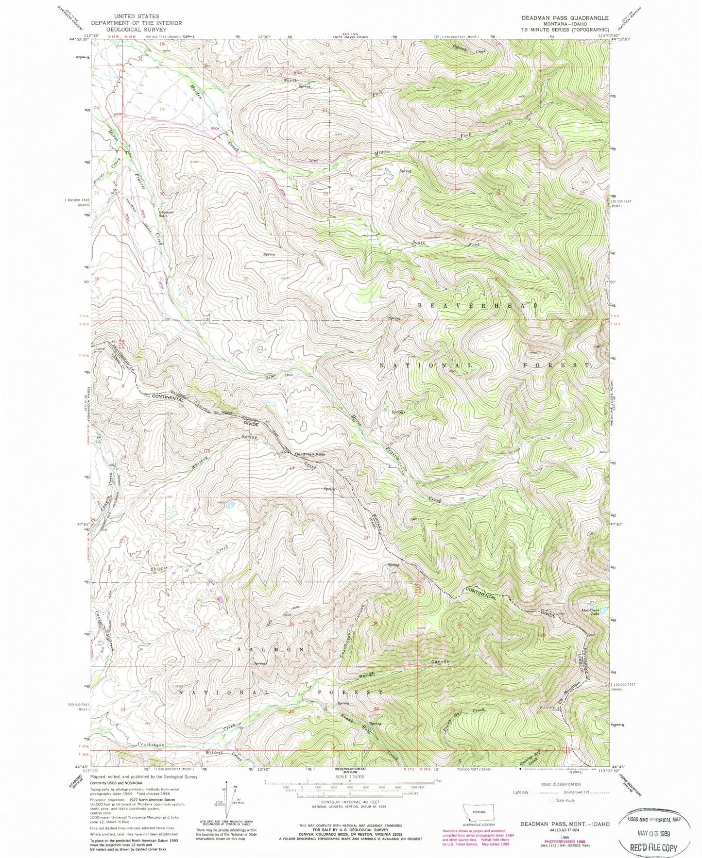
MyTopo
Classic USGS Deadman Pass Montana 7.5'x7.5' Topo Map
Couldn't load pickup availability
Historical USGS topographic quad map of Deadman Pass in the states of Montana, Idaho. Map scale may vary for some years, but is generally around 1:24,000. Print size is approximately 24" x 27"
This quadrangle is in the following counties: Beaverhead, Lemhi.
The map contains contour lines, roads, rivers, towns, and lakes. Printed on high-quality waterproof paper with UV fade-resistant inks, and shipped rolled.
Contains the following named places: Cayton Ranch, Chippie Creek, Dad Creek Lake, Deadhorse Canyon, Deadman Pass, Divide Creek, Elk Mountain, Frank Hall Creek, Horse Prairie Mountain, L-Diamond Ranch, Maiden Creek Mine, Middle Fork Maiden Creek, Rough Canyon, South Fork Maiden Creek, Whiskey Spring Creek, Wildcat Creek, Wyno