MyTopo
Classic USGS Deadman Peak Washington 7.5'x7.5' Topo Map
Couldn't load pickup availability
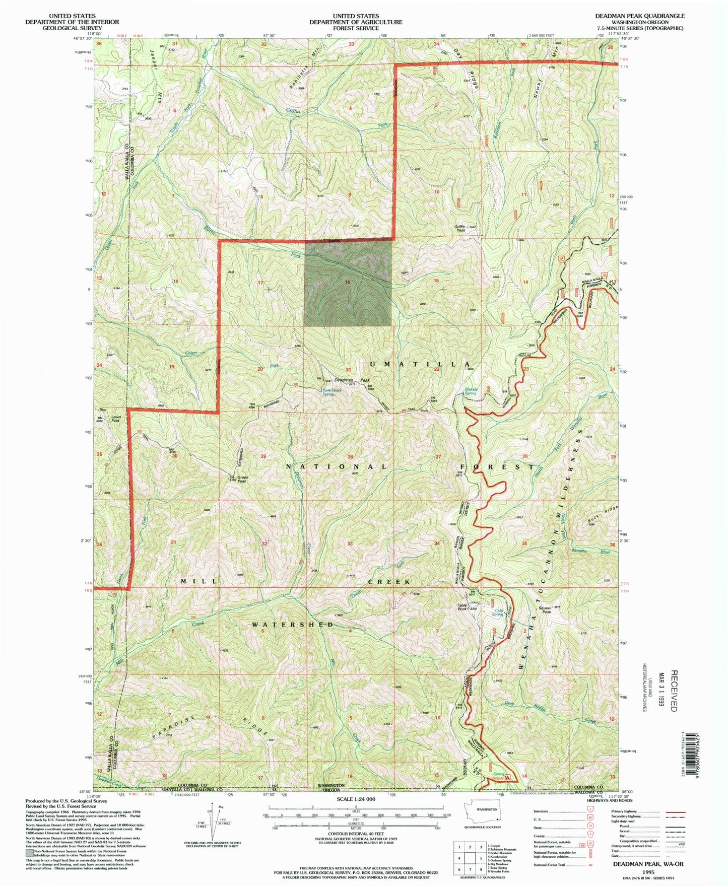
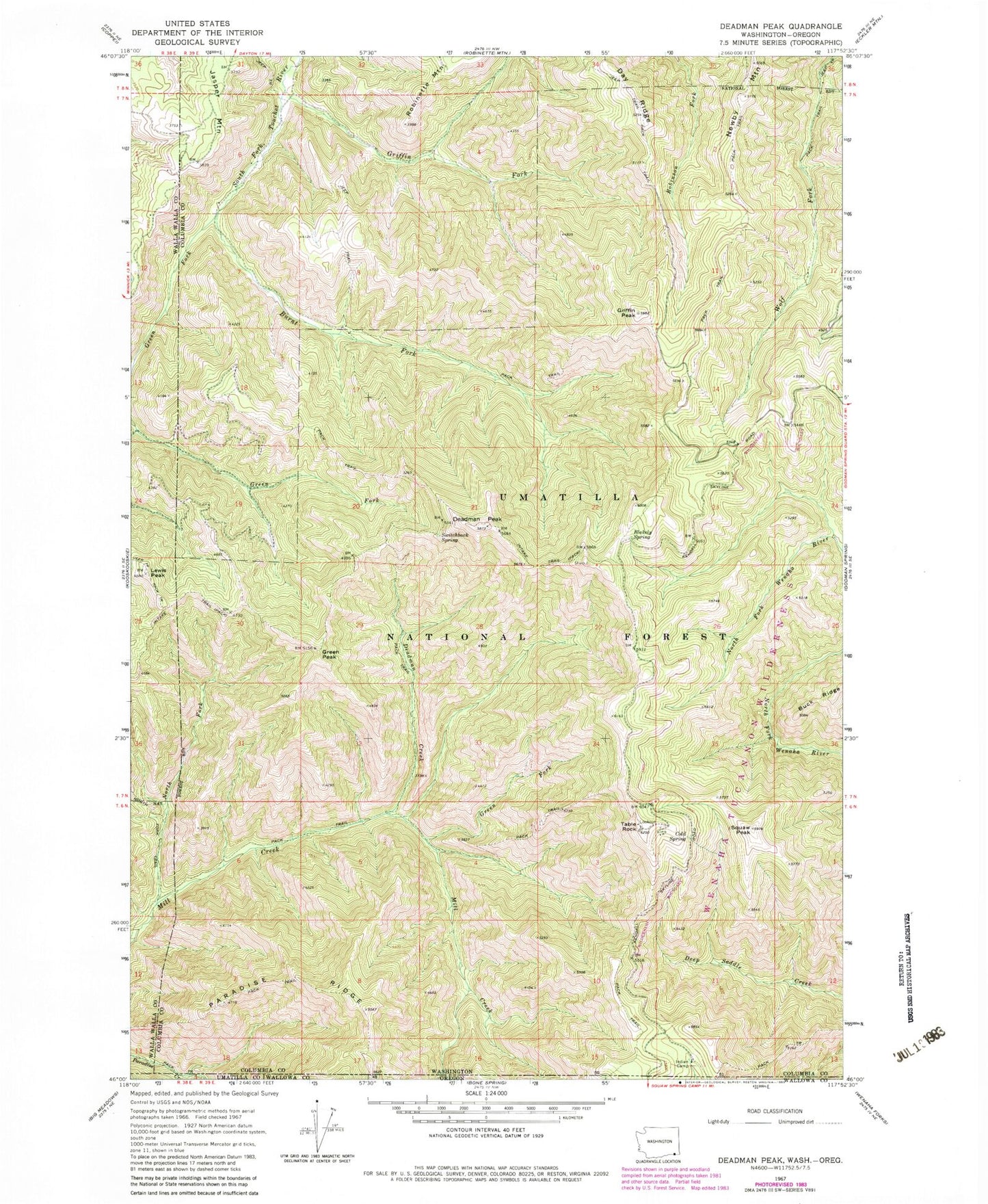
Historical USGS topographic quad map of Deadman Peak in the states of Washington, Oregon. Typical map scale is 1:24,000, but may vary for certain years, if available. Print size: 24" x 27"
This quadrangle is in the following counties: Columbia, Umatilla, Walla Walla, Wallowa.
The map contains contour lines, roads, rivers, towns, and lakes. Printed on high-quality waterproof paper with UV fade-resistant inks, and shipped rolled.
Contains the following named places: Blakely Spring, Burnt Fork, Cold Spring, Day Ridge, Deadman Creek, Green Fork, Green Fork, Griffin Fork, Griffin Peak, Intake Trail, North Fork Mill Creek, Squaw Peak, Switchback Spring, Deadman Peak, Green Peak, Lewis Peak, Table Rock, Clayton Springs, Mill Creek Watershed, Mill Creek Watershed