MyTopo
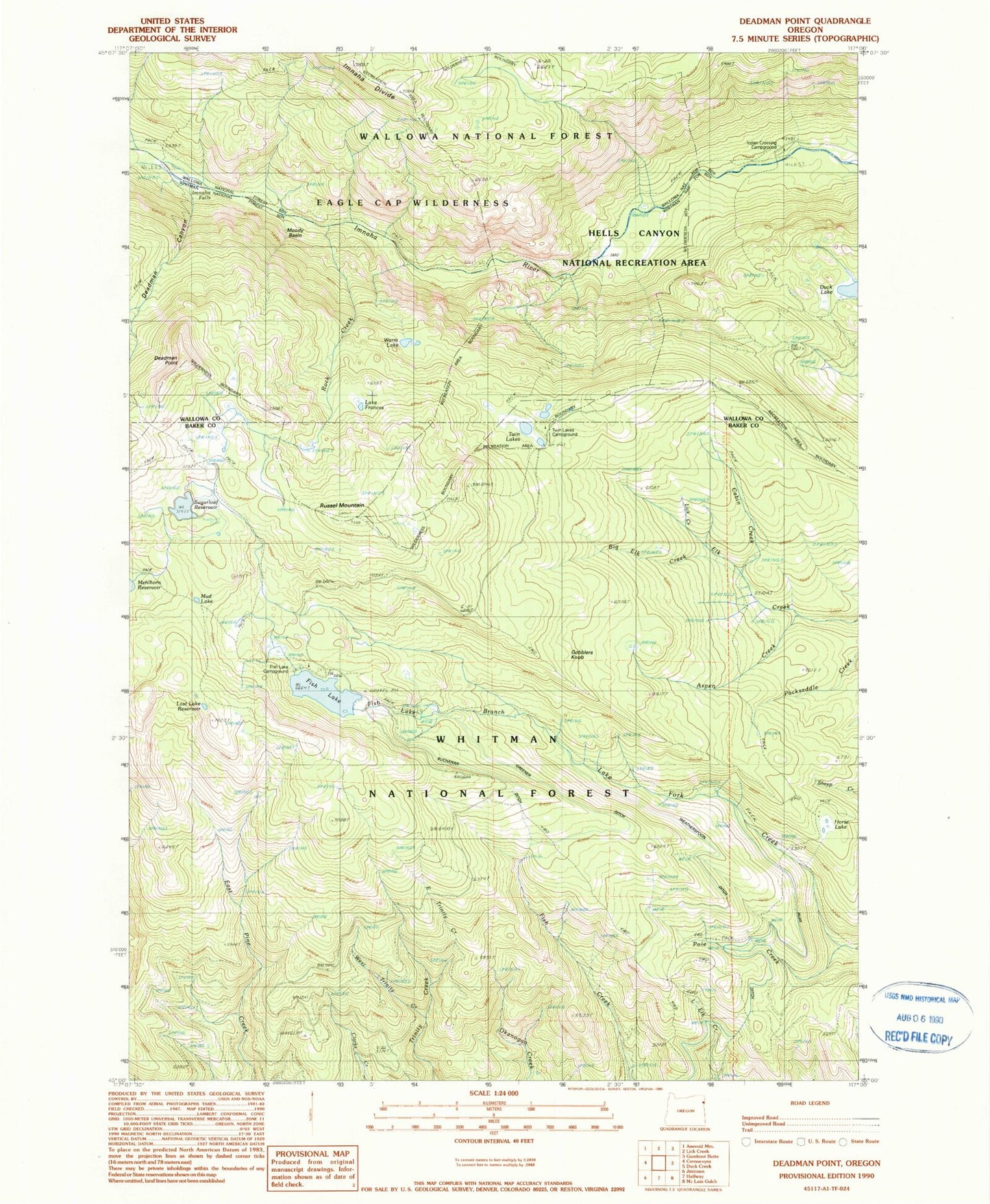
Classic USGS Deadman Point Oregon 7.5'x7.5' Topo Map
Couldn't load pickup availability
Historical USGS topographic quad map of Deadman Point in the state of Oregon. Typical map scale is 1:24,000, but may vary for certain years, if available. Print size: 24" x 27"
This quadrangle is in the following counties: Baker, Wallowa.
The map contains contour lines, roads, rivers, towns, and lakes. Printed on high-quality waterproof paper with UV fade-resistant inks, and shipped rolled.
Contains the following named places: Aspen Creek, Big Elk Creek, Cabin Creek, Deadman Canyon, Deadman Point, East Trinity Creek, Fish Lake, Fish Lake Guard Station, Lake Frances, Horse Lake, Imnaha Falls, Lick Creek, Moody Basin, Mud Lake, Pole Creek, Rock Creek, Russel Mountain, Sugarloaf Reservoir, Trinity Guard Station, Twin Lakes, Warm Lake, West Trinity Creek, Lost Lake Reservoir, Fish Lake Branch, Pole Creek, Sugarloaf Dam, Fish Lake Dam, Greener Ditch, Gobblers Knob, Fish Lake Recreation Site, Twin Lakes Recreation Site, Buchanan Ditch, Huff Ditch, Indian Crossing Recreation Site, Indian Crossing, Duck Lake, Fish Lake Campground Boat Launch