MyTopo
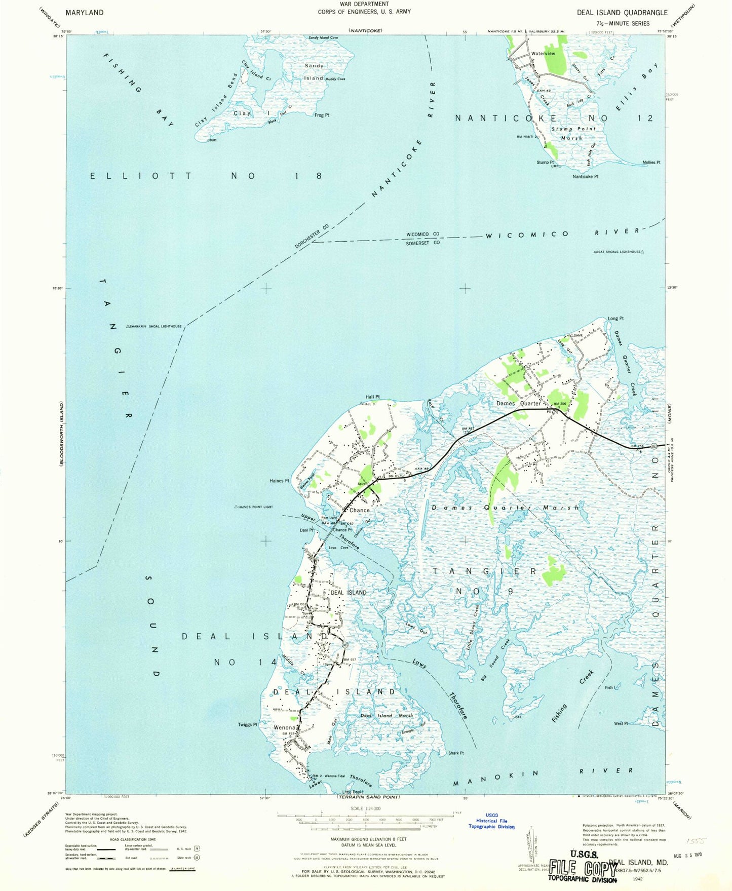
Classic USGS Deal Island Maryland 7.5'x7.5' Topo Map
Couldn't load pickup availability
Historical USGS topographic quad map of Deal Island in the state of Maryland. Map scale may vary for some years, but is generally around 1:24,000. Print size is approximately 24" x 27"
This quadrangle is in the following counties: Dorchester, Somerset, Wicomico.
The map contains contour lines, roads, rivers, towns, and lakes. Printed on high-quality waterproof paper with UV fade-resistant inks, and shipped rolled.
Contains the following named places: Back Landing Creek, Big Sound Creek, Black Duck Island, Black Foot Creek, Chance, Chance and Rock Creek Cemetery, Chance Census Designated Place, Chance Point, Clay Island, Clay Island Creek, Cow Creek, Crab Island, Dames Quarter, Dames Quarter Census Designated Place, Dames Quarter Creek, Dames Quarter Marsh, Dames Quarter Post Office, Deal Island, Deal Island - Chance Volunteer Fire Department Station 4, Deal Island Branch Library, Deal Island Census Designated Place, Deal Island Elementary School, Deal Island Marsh, Deal Island Post Office, Deal Point, District 11 Dames Quarter, District 14 Deal Island, District 9 Tangier, Duck Island, Ellis Bay, Fanneys Gut, Fish Island, Fishing Creek, Fitts Creek, Franks Island, Frog Point, Great Shoals, Great Shoals Light, Haines Point, Haines Pond, Hall Point, Jones Creek, Joshua Thomas Chapel, Laws Cove, Laws Gut, Laws Thorofare, Little Sound Creek, Long Gut, Long Point, Lower Thorofare, Macedonia United Methodist Church, Man Gut, Manbone Island, Messicks Ditch, Middle Creek, Mollies Point, Moores Gut, Muddy Cove, Nanticoke Point, Nanticoke River, Phillips Point, Rock Creek, Rock Creek Church, Rock Hole Gut, Rock Island, Saint Charles Church, Saint Johns Methodist Cemetery, Saint Johns United Methodist Church, Saint Pauls Church, Sandy Island, Scotts Cove, Shark Fin Shoal, Shark Point, Sharkfin Shoal Channel, Sharkfin Shoal Lighthouse, Somerset Church, Stacey Gut, Straight Gut, Stump Point, Stump Point Marsh, Twiggs Point, Upper Thorofare, Waterview, Waterview Census Designated Place, Wenona, Wenona Post Office, Wesley Church, West Point, Wicomico River, ZIP Codes: 21821, 21840