
MyTopo
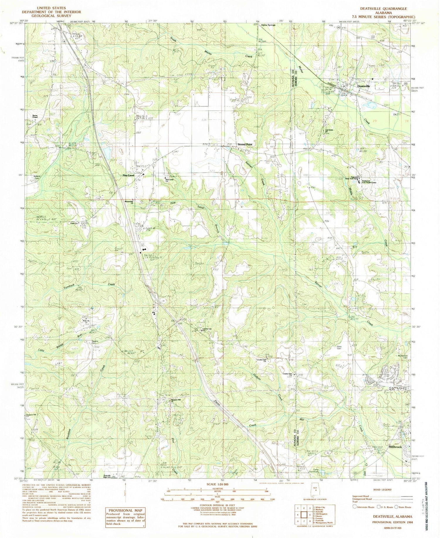
Classic USGS Deatsville Alabama 7.5'x7.5' Topo Map
Couldn't load pickup availability
Historical USGS topographic quad map of Deatsville in the state of Alabama. Map scale may vary for some years, but is generally around 1:24,000. Print size is approximately 24" x 27"
This quadrangle is in the following counties: Autauga, Elmore.
The map contains contour lines, roads, rivers, towns, and lakes. Printed on high-quality waterproof paper with UV fade-resistant inks, and shipped rolled.
Contains the following named places: Alpha Springs, Andrew, Boones Chapel Baptist Church, Camp Montauga, Circle A Ranch Dam, Circle A Ranch Lake, County Line Cemetery, County Line Church, Deatsville, Deatsville Church, Deatsville Elementary School, Deatsville Fire Department, Deatsville Post Office, Faith Church, Franklee Correctional Youth Center, Grandview Pines, Holland Cemetery, Hudson Creek, Ingram State Technical Institute, Kenner Creek, Knollwood, Liberty Baptist Church, Lily Green Church, Maranatha Church, McKeithen Cemetery, Millbrook Fire Department Station 2, New Nazareth Church, Owens Cemetery, Pierce Creek, Pine Haven School, Pine Level, Pine Level Branch, Pine Level Cemetery, Pine Level Census Designated Place, Pine Level Methodist Church, Pine Level Volunteer Fire Department, Pink Lily Baptist Church, Pleasant Hill African Methodist Episcopal Church, Pleasant Hill Cemetery, Prattville Country Club, Prattville High School, Robinson Springs, Robinson Springs United Methodist Church, Ross Cemetery, Shady Acres, South Mortar Creek, Stoney Point, Stoney Point Cemetery, Tatum Cemetery, Town of Deatsville, Tuskpoka, White School, ZIP Code: 36022