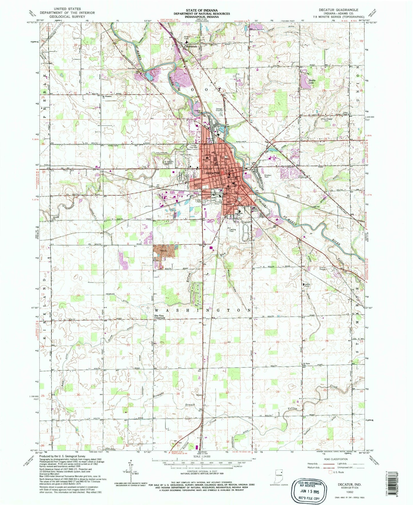
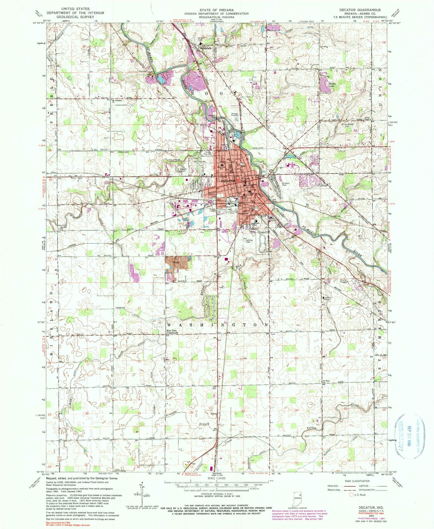
MyTopo
Classic USGS Decatur Indiana 7.5'x7.5' Topo Map
Couldn't load pickup availability
Historical USGS topographic quad map of Decatur in the state of Indiana. Map scale may vary for some years, but is generally around 1:24,000. Print size is approximately 24" x 27"
This quadrangle is in the following counties: Adams.
The map contains contour lines, roads, rivers, towns, and lakes. Printed on high-quality waterproof paper with UV fade-resistant inks, and shipped rolled.
Contains the following named places: Adams County Emergency Medical Services, Adams County Home, Adams County Sheriff's Office, Adams Memorial Hospital, Antioch Church, Ayers Ditch, Blair Ditch, Bluhm Ditch, Borum Run, City of Decatur, Decatur, Decatur Cemetery, Decatur Fire Department, Decatur Police Department, Decatur Post Office, Elm Tree Crossroads, Gage Airport, Hahnert Ditch, Hanna City Park, Hendricks Ditch, Hessler Ditch, Holthouse Ditch, Kohne Number One Ditch, Kohne Number Two Ditch, Koos Ditch, Lincoln Amish School Number Two, McMillen Park, Miller Ditch, Monmouth, Mount Pleasant Church, Northwest Elementary School, Ohler Ditch, Ruppert Ditch, Saddle Lake, Saddle Lake Dam, Saint Joseph Cemetery, Saint Josephs School, Saint Pauls Church, Southeast Elementary School, Straight Branch, Stratton Park, Township of Washington, Union Chapel, Union Chapel Cemetery, WADM-AM (Decatur), WADM-FM (Decatur), Yellow Creek, ZIP Code: 46733