
MyTopo
Classic USGS Decatur Mississippi 7.5'x7.5' Topo Map
Couldn't load pickup availability
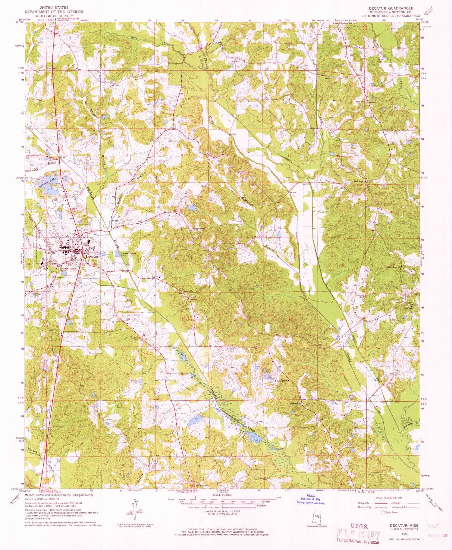
Historical USGS topographic quad map of Decatur in the state of Mississippi. Map scale may vary for some years, but is generally around 1:24,000. Print size is approximately 24" x 27"
This quadrangle is in the following counties: Newton.
The map contains contour lines, roads, rivers, towns, and lakes. Printed on high-quality waterproof paper with UV fade-resistant inks, and shipped rolled.
Contains the following named places: B L Griffin Lake Dam, Beulah Church, Beulah School, Blounts Store, Brand Cemetery, C Loper Catfish Pond Dam, C M Blount Lake Dam, Carlton Branch, Chaney Store, Chapel Hill School, Chunky Canal, Chunky Watershed Structure 5 Dam, Cleveland Branch, Concobona Creek, Decatur, Decatur Attendance Center, Decatur Branch, Decatur Cemetery, Decatur Police Department, Decatur Post Office, Decatur Volunteer Fire Department, Dry Branch, East Central Community College, Ecjc Lake Dam, Good Hope Church, Goodhope, Graham Store, Greenwood Church, Hale Branch, Hallman Branch, High Heel School, John Cook Branch, Johnson Cemetery, Laird Branch, Lebanon, Lebanon Church, Liberty Hill School, Little Rock, Little Rock Church, Majure Church, McMullan Branch, Midway Church, Newton County, Newton County Sheriff's Office, Oakland Church, Okahatta Canal, Osborn Lake Dam, Ozborn Lake, Reeves Branch, Roman Hill Church, Roscoe, Shady Grove Church, Storys Store, Supervisor District 1, Supervisor District 2, Tallashua Creek, Tommy Graham Pond Dam, Town of Decatur, Williams Store, Witt Creek, Witts School, ZIP Code: 39327


