MyTopo
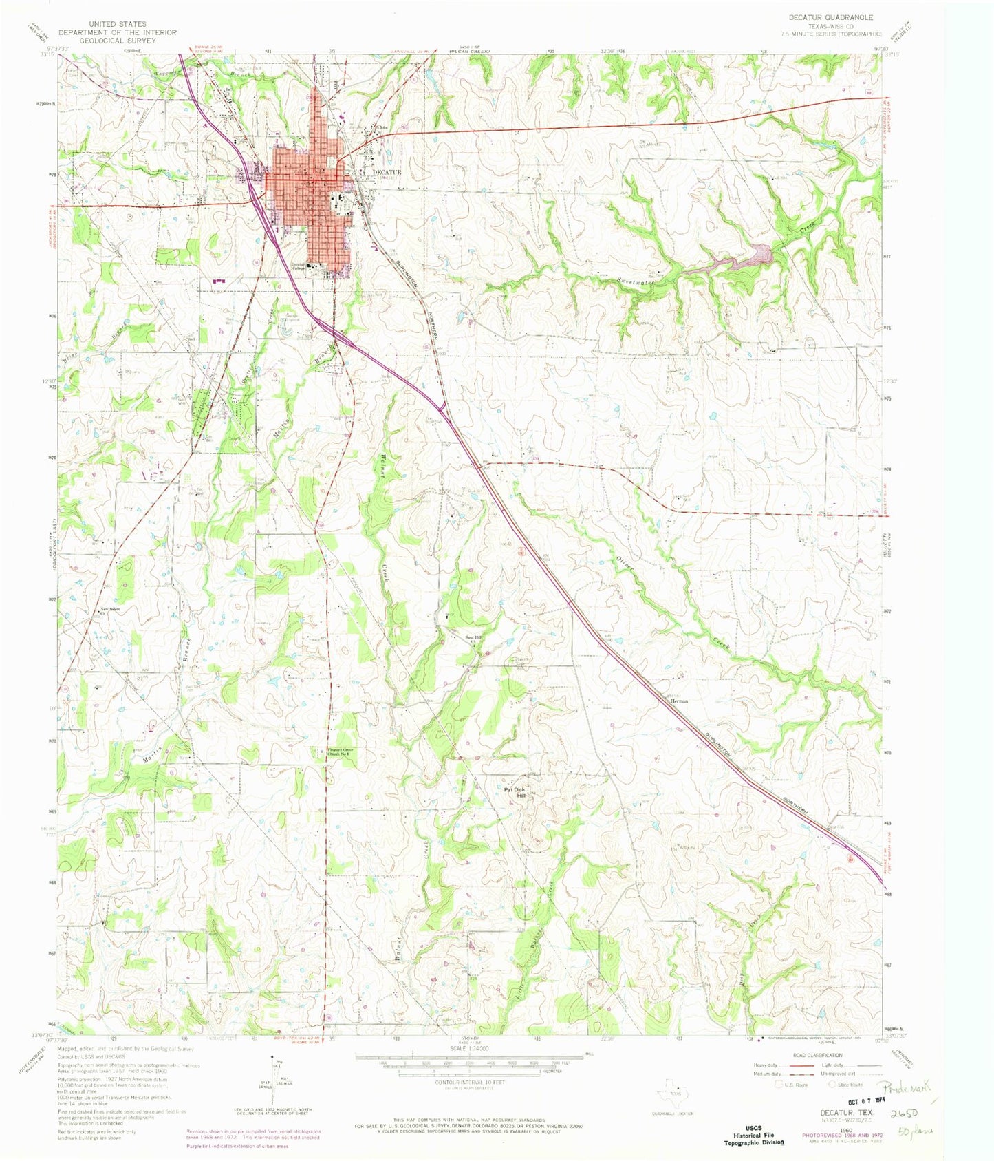
Classic USGS Decatur Texas 7.5'x7.5' Topo Map
Couldn't load pickup availability
Historical USGS topographic quad map of Decatur in the state of Texas. Map scale may vary for some years, but is generally around 1:24,000. Print size is approximately 24" x 27"
This quadrangle is in the following counties: Wise.
The map contains contour lines, roads, rivers, towns, and lakes. Printed on high-quality waterproof paper with UV fade-resistant inks, and shipped rolled.
Contains the following named places: Annaville Cemetery, Bell Church, Bethel Cemetery, Catholic Church of the Assumption, Center Creek, Church of Christ, City of Decatur, Cornerstone Church of the Nazarene, Decatur, Decatur Baptist College Administration Building, Decatur City Hall, Decatur City Public Works, Decatur College, Decatur Elementary School, Decatur Fire Department, Decatur Fire Department Central Fire Station, Decatur High School, Decatur Intermediate School, Decatur Learning Center, Decatur Middle School, Decatur Police Department, Decatur Post Office, Eagle Drive Baptist Church, Eagle Stadium, First United Pentecostal Church of Decatur, Flat Bush Airport, Herman, LifeStar 4 - Southwest Helicopters - Decatur, Mc Entire Airport, New Salem Church, Pat Dick Hill, Pleasant Grove Church Number 1, Primera Iglesia Bautista Church, Red Ace Ranch Airport, Saint John Church, Sand Hill Cemetery, Sand Hill Church, Soil Conservation Service Site 24 Dam, Soil Conservation Service Site 24 Reservoir, Texas Tourist Camp, Waggoner Mansion, Wise County Constable's Office Precinct 1, Wise County Emergency Medical Services, Wise County Heritage Museum, Wise County Jail, Wise County Sheriff's Office, Wise Regional Health System East Campus, Wise Regional Health System West Campus