
MyTopo
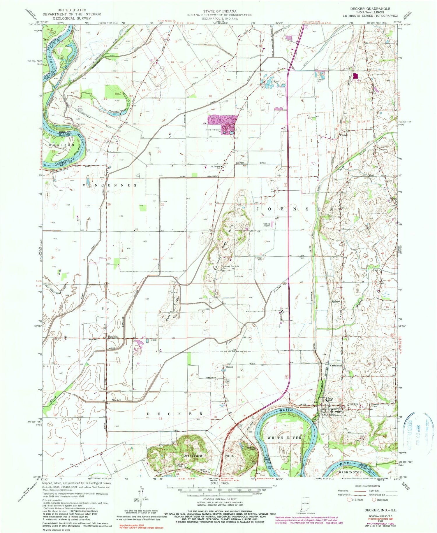
Classic USGS Decker Indiana 7.5'x7.5' Topo Map
Couldn't load pickup availability
Historical USGS topographic quad map of Decker in the states of Indiana, Illinois. Map scale may vary for some years, but is generally around 1:24,000. Print size is approximately 24" x 27"
This quadrangle is in the following counties: Gibson, Knox, Lawrence.
The map contains contour lines, roads, rivers, towns, and lakes. Printed on high-quality waterproof paper with UV fade-resistant inks, and shipped rolled.
Contains the following named places: Bandmill, Bandmill Field, Bedell Cemetery, Cane Ridge, Cantaloupe, Chimney Pier Hills, Chimney Pier Hills Cemetery, Decker, Decker Post Office, Dick Cemetery, Dicksburg Hills, Eke Drainage System Ditch, Horseshoe Pond, Johnson Township Volunteer Fire Department, King Bend, Mantle Ditch, Muddy Run, Plass Ditch, Purcell, Saint Peter Lutheran Cemetery, Saint Peters Lutheran School, Saint Thomas, Saint Thomas Pit, Saint Thomas School, Sisson, Stuart Cemetery, Swan Pond Ditch, Town of Decker, Township of Johnson, Ueding Airport, Upper River Deshee, Vieke Drainage System Ditch, Vollmer, Warth Cemetery


