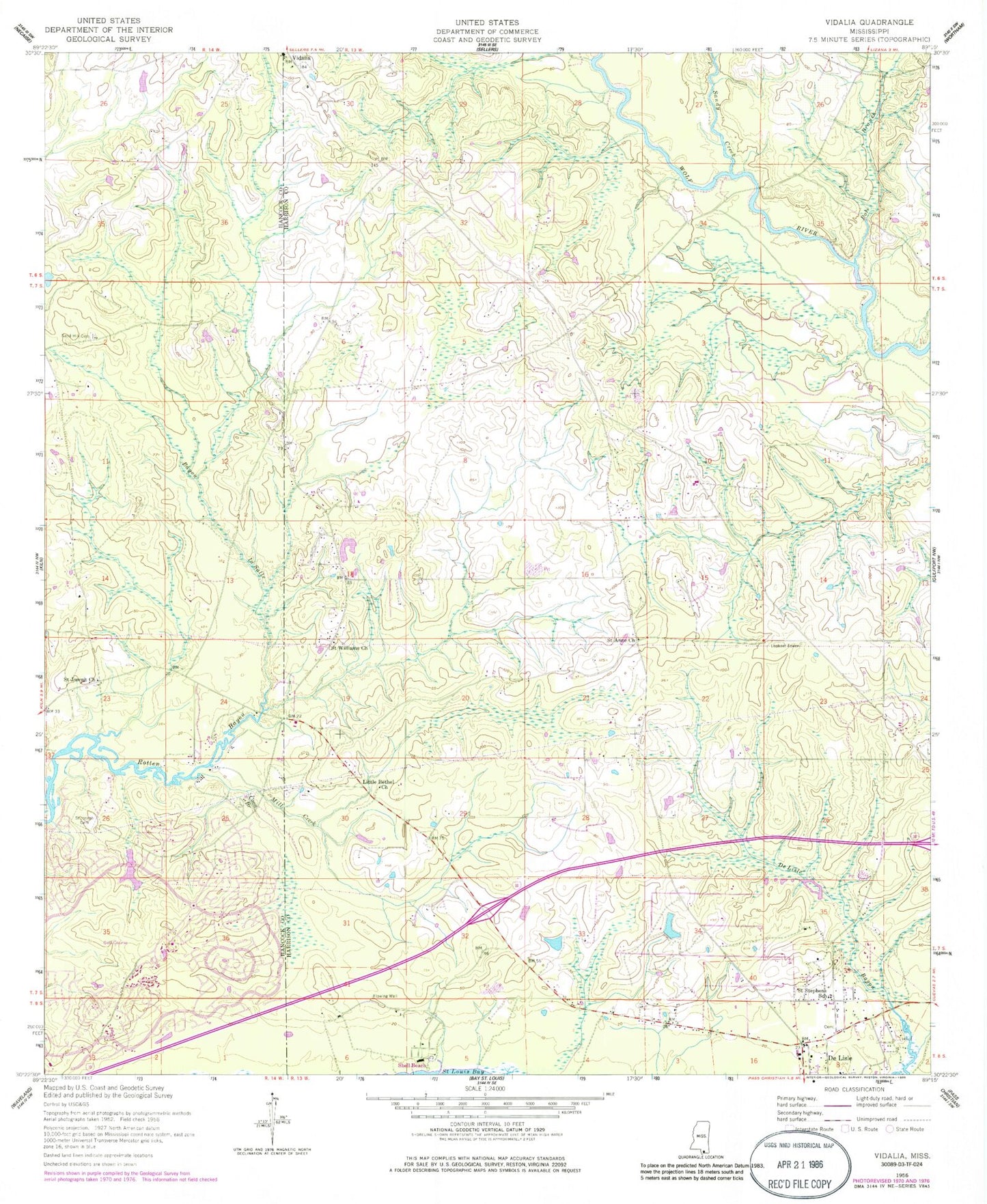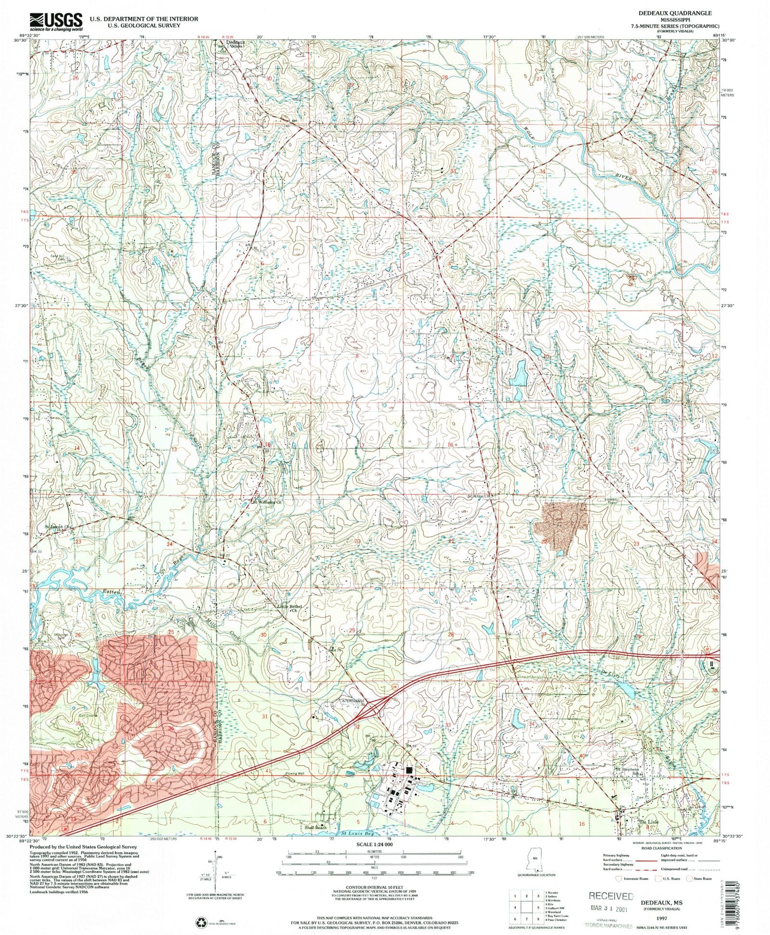
MyTopo
Classic USGS Dedeaux Mississippi 7.5'x7.5' Topo Map
Couldn't load pickup availability
Historical USGS topographic quad map of Dedeaux in the state of Mississippi. Map scale may vary for some years, but is generally around 1:24,000. Print size is approximately 24" x 27"
This quadrangle is in the following counties: Hancock, Harrison.
The map contains contour lines, roads, rivers, towns, and lakes. Printed on high-quality waterproof paper with UV fade-resistant inks, and shipped rolled.
Contains the following named places: Addison-Henley Field, Alphonse G Malley Memorial Cemetery, Bayou La Terre, Bayou Lasalle, City of Diamondhead, Coon Branch, De Lisle, Dedeaux, DeLisle Census Designated Place, Diamondhead, Diamondhead Census Designated Place, Diamondhead Country Club, Diamondhead Fire Department, Diamondhead Post Office, Fenton Volunteer Fire Department, First Baptist Church of Delisle, Grace Chapel Church, Harrison County Fire Rescue Station Number 6, Harrison County Fire Service Fire Station 7, Little Bethel Church, Mill Creek, Mount Zion United Methodist Church, Pass Christian Middle School, Pickens Lagoon, Polar Branch, Sacred Heart Parish and Church, Saint Anne Church, Saint Joseph Cemetery, Saint Joseph Church, Saint Stephens Catholic Church, Saint Williams Church, Sandy Creek, Shell Beach, Stephens School, Supervisor District 3, The Oaks Golf Club, Vidalia Road Mobile Home Park, ZIP Codes: 39525, 39571