MyTopo
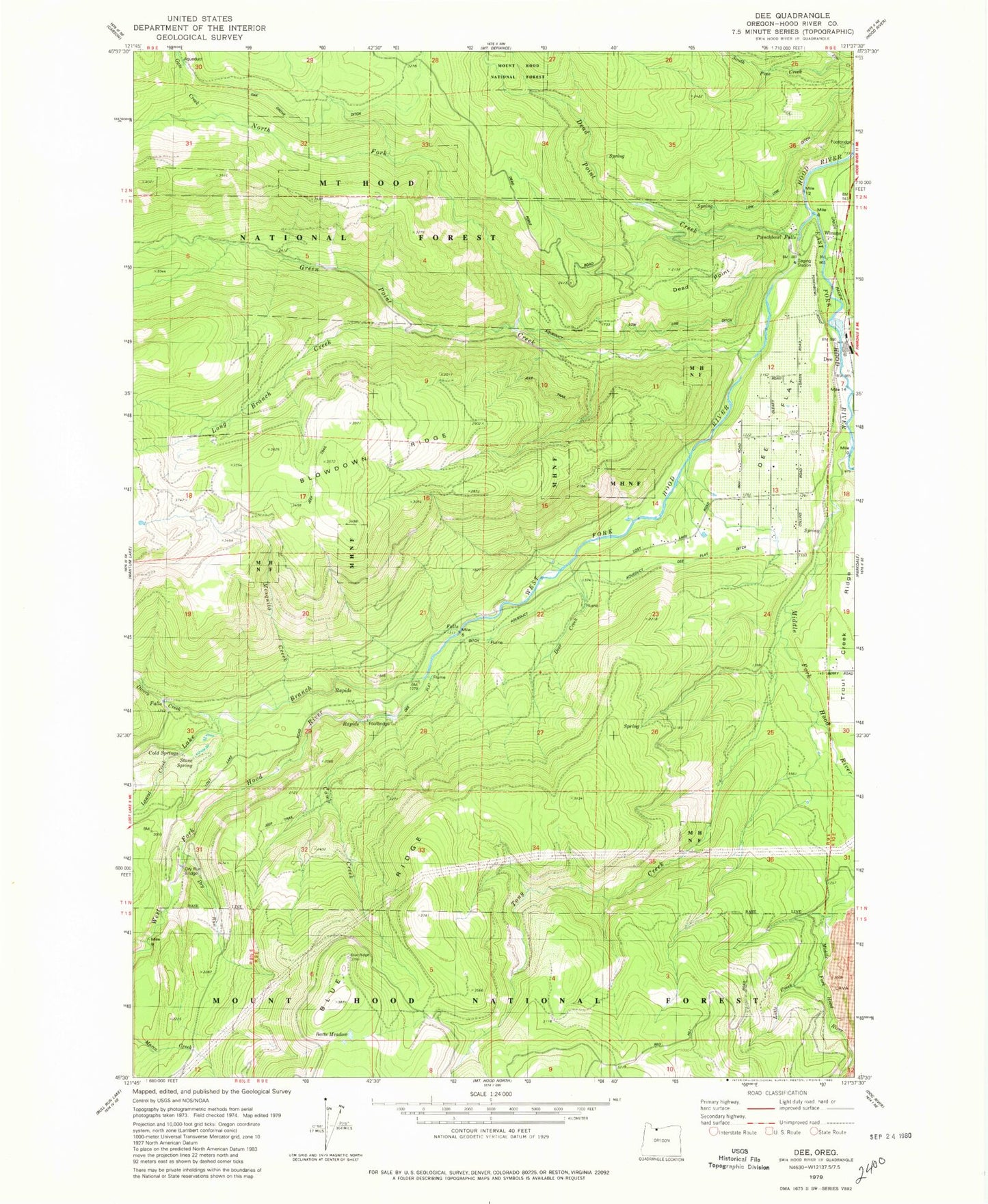
Classic USGS Dee Oregon 7.5'x7.5' Topo Map
Couldn't load pickup availability
Historical USGS topographic quad map of Dee in the state of Oregon. Typical map scale is 1:24,000, but may vary for certain years, if available. Print size: 24" x 27"
This quadrangle is in the following counties: Hood River.
The map contains contour lines, roads, rivers, towns, and lakes. Printed on high-quality waterproof paper with UV fade-resistant inks, and shipped rolled.
Contains the following named places: Mosquito Creek, Winans, Batts Meadow, Birdie Creek, Blowdown Ridge, Camp Creek, Cold Springs, Dead Point, Dee, Dee Flat, Dee Flat Ditch, Divers Creek, Dry Run Bridge, East Fork Hood River, Gate Creek, Green Point Creek, Lake Branch, Laurel Creek, Lava Springs, Little Creek, Long Branch Creek, Middle Fork Hood River, North Fork Green Point Creek, Oak Grove Ditch, Punchbowl Falls, South Pine Creek, Stone Spring, Tony Creek, Upper Hood River Valley, West Fork Hood River, Shingle Creek, Searra Casa Reservoir, Savage Springs, Japanese Springs, Ice Fountain Spring, Dee Flat Guard Station, Dago Spring, Crystal Springs, Cedar Branch, Capron Spring, Dead Point Spring, Hood River Hatchery, Hood River County, Dry Run, Low Line Ditch, Winan Spring, Dee Post Office (historical), Dee Flat Seed Orchard, Dead Point Creek, Dee Division, Harry Wollam Grave, Dee Rural Fire Protection District