MyTopo
Classic USGS Deedsville Indiana 7.5'x7.5' Topo Map
Couldn't load pickup availability
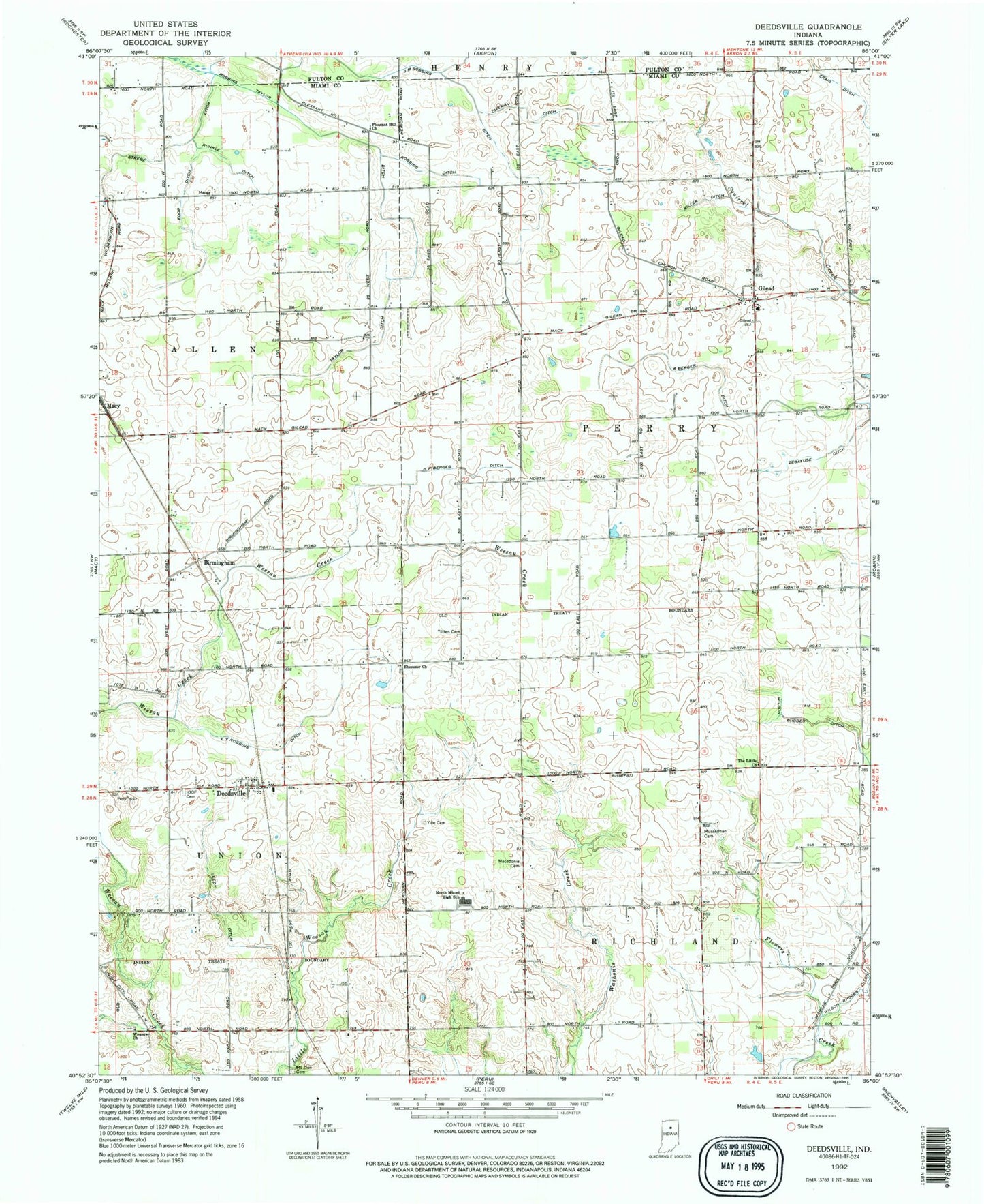
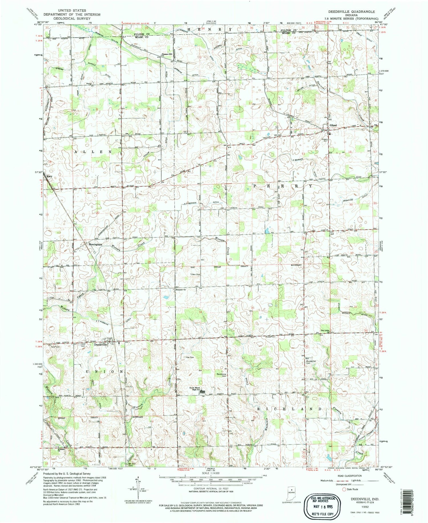
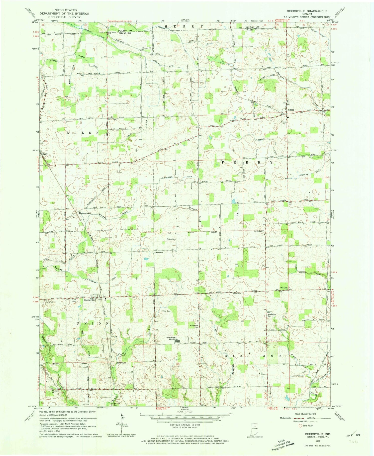
Historical USGS topographic quad map of Deedsville in the state of Indiana. Map scale may vary for some years, but is generally around 1:24,000. Print size is approximately 24" x 27"
This quadrangle is in the following counties: Fulton, Miami.
The map contains contour lines, roads, rivers, towns, and lakes. Printed on high-quality waterproof paper with UV fade-resistant inks, and shipped rolled.
Contains the following named places: Aberger Ditch, Birmingham, Bower Ditch, Deedsville, Deedsville Post Office, Dielman Ditch, E V Robbins Ditch, Ebenezer Church, Foor Ditch, Gilead, H P Berger Ditch, Independent Order of Odd Fellows Cemetery, J M Robbins Ditch, Leedy Ditch, Macedonia Cemetery, Miller Ditch, Mount Zion Cemetery, Musselman Cemetery, North Miami Consolidated Elementary School, North Miami High School, Pleasant Hill Church, Robbins Ditch, Robbins Taylor Ditch, Runkle Ditch, Taylor Ditch, The Little Church, Tilden Cemetery, Township of Allen, Township of Perry, Township of Union, Weasaw Church, Wildermuth Strebe Ditch, Yike Cemetery, Zegafuse Ditch, ZIP Codes: 46926, 46951