MyTopo
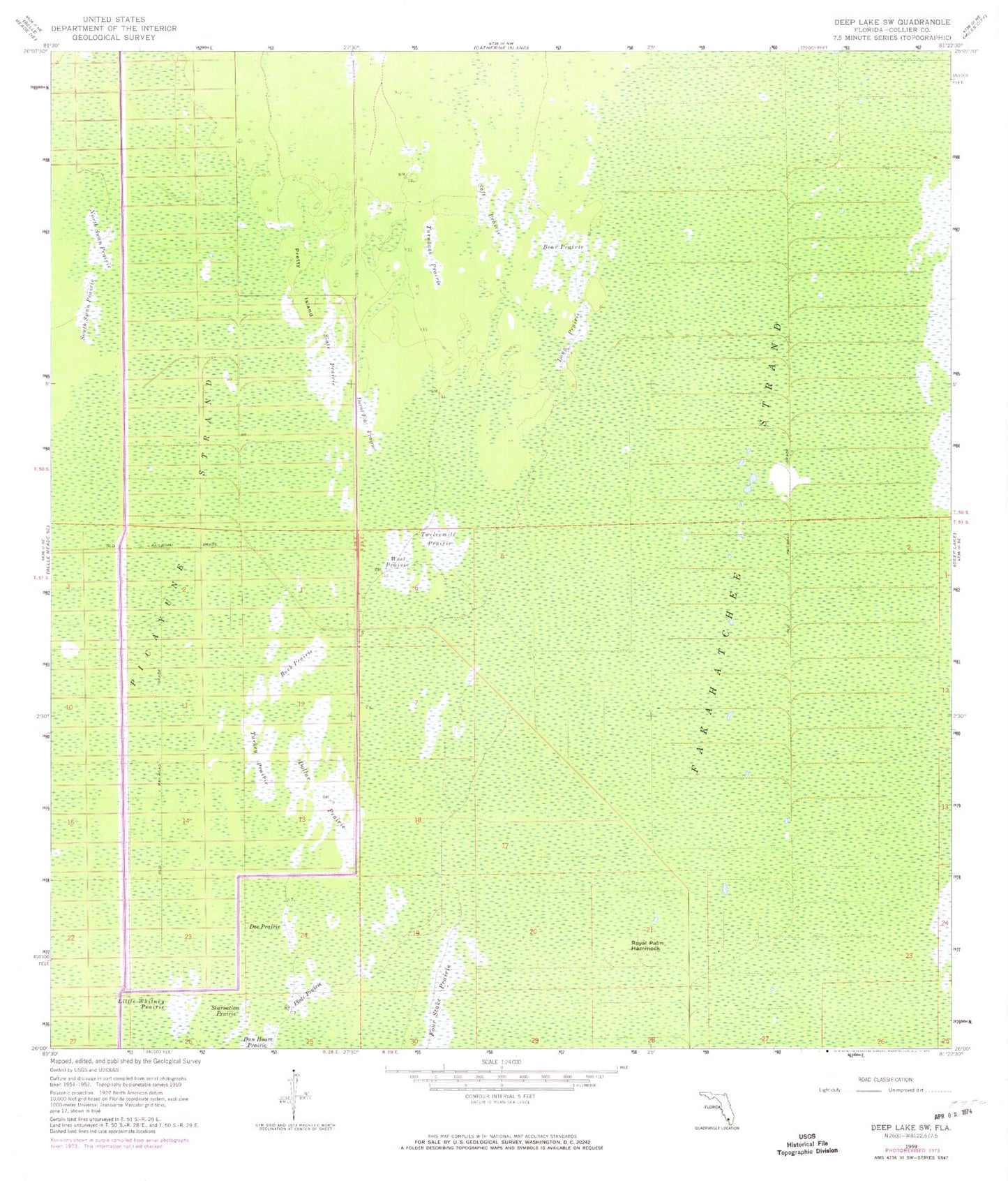
Classic USGS Deep Lake SW Florida 7.5'x7.5' Topo Map
Couldn't load pickup availability
Historical USGS topographic quad map of Deep Lake SW in the state of Florida. Map scale may vary for some years, but is generally around 1:24,000. Print size is approximately 24" x 27"
This quadrangle is in the following counties: Collier.
The map contains contour lines, roads, rivers, towns, and lakes. Printed on high-quality waterproof paper with UV fade-resistant inks, and shipped rolled.
Contains the following named places: Bear Prairie, Buck Prairie, Burnt Flat Prairie, Collier County, Doe Prairie, Dollar Prairie, Fakahatchee Strand, Fakahatchee Strand Preserve State Park, Little Whitney Prairie, Long Prairie, Picayune Strand, Plate Prairie, Pretty Island, Royal Palm Hammock, Slate Prairie, Soft Prairie, Starvation Prairie, Turkey Prairie, Turnback Prairie, Twelvemile Prairie, West Prairie