MyTopo
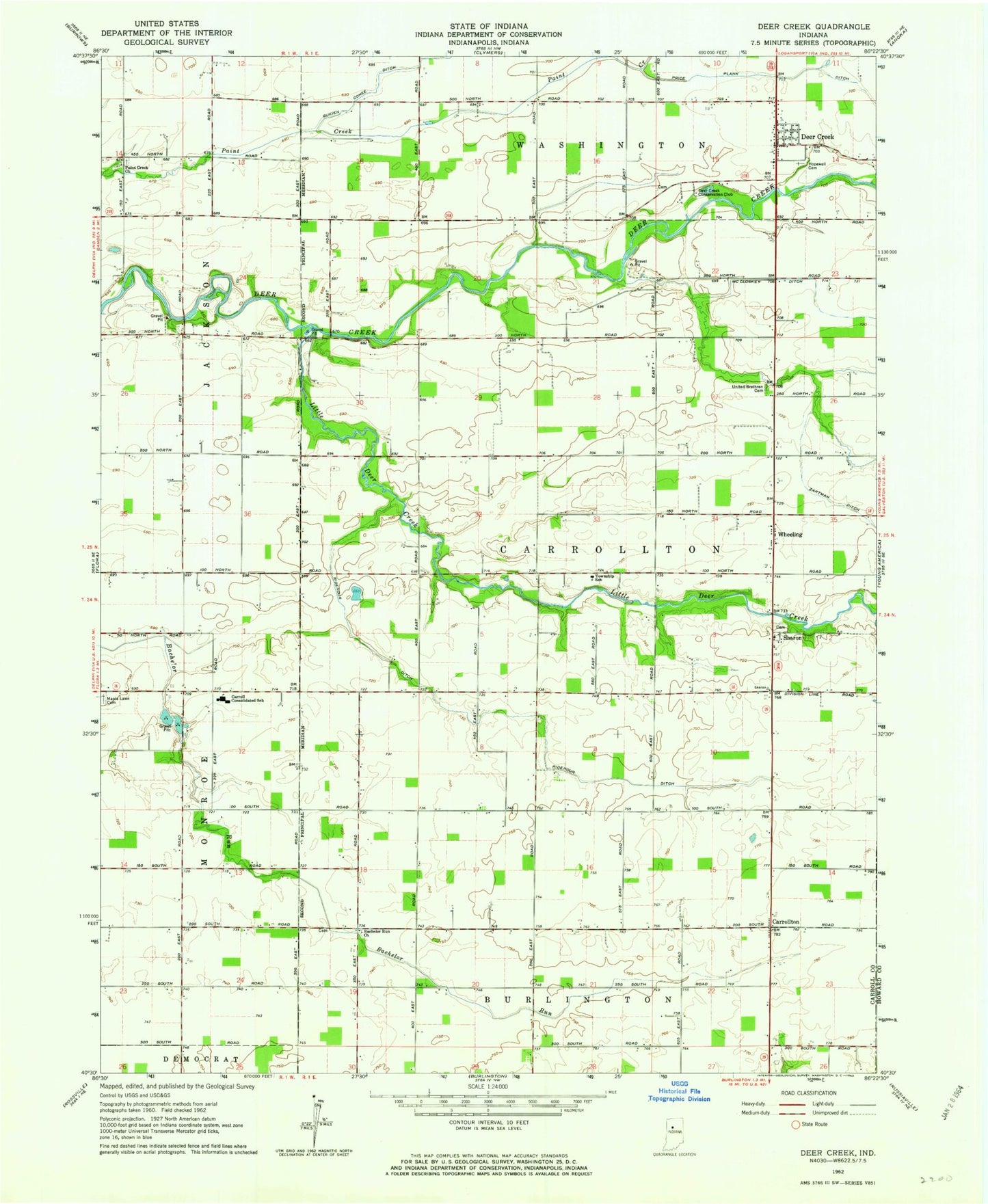
Classic USGS Deer Creek Indiana 7.5'x7.5' Topo Map
Couldn't load pickup availability
Historical USGS topographic quad map of Deer Creek in the state of Indiana. Map scale may vary for some years, but is generally around 1:24,000. Print size is approximately 24" x 27"
This quadrangle is in the following counties: Carroll, Howard.
The map contains contour lines, roads, rivers, towns, and lakes. Printed on high-quality waterproof paper with UV fade-resistant inks, and shipped rolled.
Contains the following named places: Bachelor Run Church, Carroll County Emergency Medical Services, Carroll Junior-Senior High School, Carrollton, Deer Creek, Deer Creek Census Designated Place, Deer Creek Conservation Club, Deer Creek United Brethren Cemetery, Hopewell Cemetery, Little Deer Creek, Maple Lawn Cemetery, McCloskey Ditch, Paint Creek Church, Price Plank Ditch, Ridenour Ditch, Sharon, Township of Carrollton, Wheeling, Zartman Ditch, ZIP Code: 46929