MyTopo
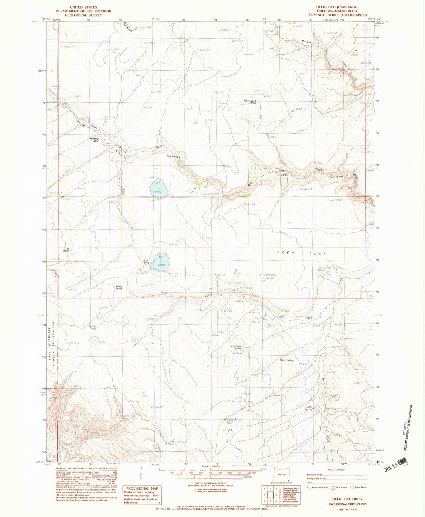
Classic USGS Deer Flat Oregon 7.5'x7.5' Topo Map
Regular price
$16.95
Regular price
Sale price
$16.95
Unit price
per
Couldn't load pickup availability
Historical USGS topographic quad map of Deer Flat in the state of Oregon. Map scale may vary for some years, but is generally around 1:24,000. Print size is approximately 24" x 27"
This quadrangle is in the following counties: Malheur.
The map contains contour lines, roads, rivers, towns, and lakes. Printed on high-quality waterproof paper with UV fade-resistant inks, and shipped rolled.
Contains the following named places: Andersons Corral, Bend Spring, Cat Spring, Cold Spring, Deer Creek, Deer Flat, Horse Hill Spring, Indian Spring, Jack Creek Spring, Lake Fork West Owyhee River, Lime Spring, Pedroli Spring, Spare Spring