MyTopo
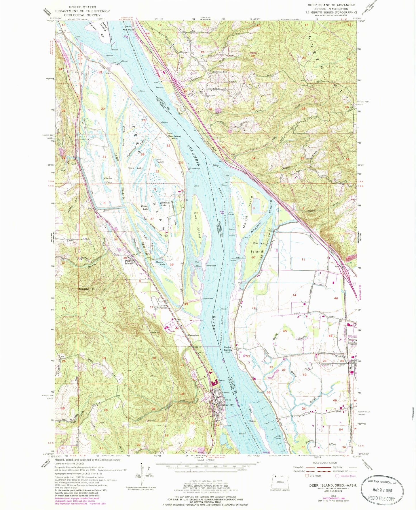
Classic USGS Deer Island Oregon 7.5'x7.5' Topo Map
Couldn't load pickup availability
Historical USGS topographic quad map of Deer Island in the states of Oregon, Washington. Map scale may vary for some years, but is generally around 1:24,000. Print size is approximately 24" x 27"
This quadrangle is in the following counties: Columbia, Cowlitz.
The map contains contour lines, roads, rivers, towns, and lakes. Printed on high-quality waterproof paper with UV fade-resistant inks, and shipped rolled.
Contains the following named places: Adams Creek, Adams Lake, Ahle Point, Benham Slough, Box Lake, Burke Creek, Burke Island, Burke Slough, Burris Creek, Bybee Creek, Bybee Ledge Channel, Canyon Creek, Caples, Caples House Museum, Caples Landing, Carolyn King Memorial Park, Charlton, City of Columbia City, City of Woodland, Cloverdale, Cloverdale School, Columbia City, Columbia City Channel, Columbia City City Hall, Columbia City Community Library, Columbia City Municipal Court, Columbia City Police Department, Columbia City Post Office, Columbia City Public Works, Columbia City School, Columbia River Fire and Rescue - Deer Island Station, Columbia River Fire and Rescue Columbia City, Columbia Safety Rest Area, Cottonwood Lake, Cowlitz County Fire District 5 Station 52, Crown Zellerbach Number 4, CZ Tracks 1 2 and 3, Datis City Park, Daves Slough, Deer Island, Deer Island Census Designated Place, Deer Island Point, Deer Island Post Office, Deer Island Slough, Ferndale School, Goat Island, Goerig Slough, Harrie Creek, Harvard City Park, Horsepasture Lake, Hunter Bar, Hunters Post Office, Jim Bundy Memorial Park, Kalama Upper Range, Kinder Cemetery, Lake Adams, Lake Koinenia, Lloyd Hill Dam, Maple Hill, Martin Bluff, Martin Island, Martin Island Channel, Martin Slough, Masonic Cemetery, McBride, McBride Creek, Merrill Creek, Mill Creek, Muckle Lake, Multnomah Channel, Murphy, Nehalem Junction, Oak Ridge Lake, Pixie Park, Resting Lake, Ruth Rose Richardson Park, Saint Helens Range, Schoolhouse Creek, Swan Lake, Thorn Lake, Tide Creek, Waterview, Western Spar Company Spur, Woodland High School, Woodland Primary School, ZIP Code: 97018