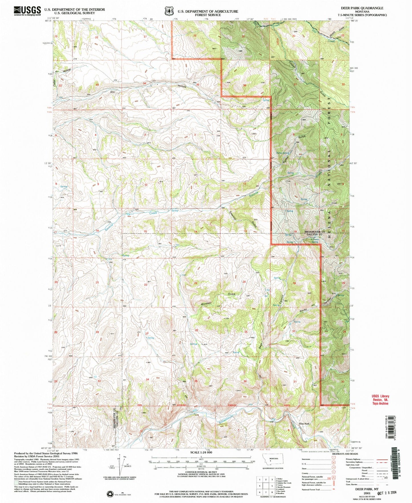
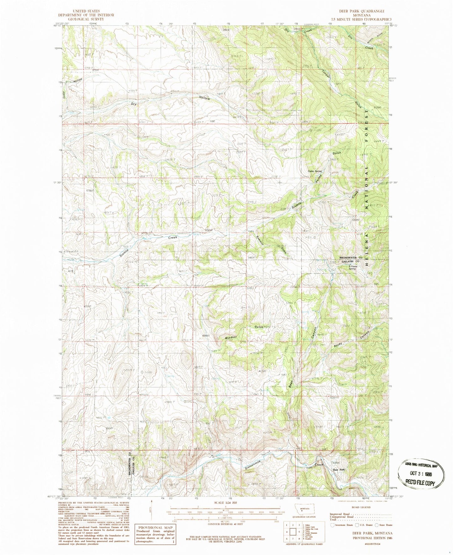
MyTopo
Classic USGS Deer Park Montana 7.5'x7.5' Topo Map
Regular price
$16.95
Regular price
Sale price
$16.95
Unit price
per
Couldn't load pickup availability
Historical USGS topographic quad map of Deer Park in the state of Montana. Typical map scale is 1:24,000, but may vary for certain years, if available. Print size: 24" x 27"
This quadrangle is in the following counties: Broadwater, Gallatin.
The map contains contour lines, roads, rivers, towns, and lakes. Printed on high-quality waterproof paper with UV fade-resistant inks, and shipped rolled.
Contains the following named places: Rocky Canyon, Crane School (historical), Deer Park, Miners Gulch, Timber Gulch, Bean Canyon, Windsor Gulch, Farley Gulch, Sawmill Gulch, A Frame Spring, Cedar Hollow, Farley Spring, 06N03E32DD__01 Well, 06N03E34AC__01 Well, Shull (historical)