MyTopo
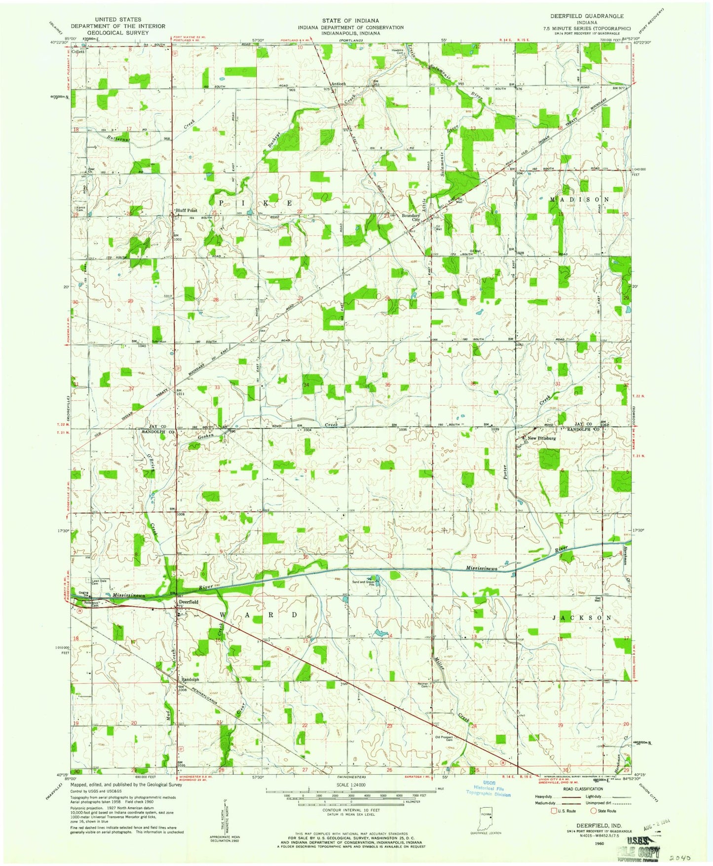
Classic USGS Deerfield Indiana 7.5'x7.5' Topo Map
Couldn't load pickup availability
Historical USGS topographic quad map of Deerfield in the state of Indiana. Map scale may vary for some years, but is generally around 1:24,000. Print size is approximately 24" x 27"
This quadrangle is in the following counties: Jay, Randolph.
The map contains contour lines, roads, rivers, towns, and lakes. Printed on high-quality waterproof paper with UV fade-resistant inks, and shipped rolled.
Contains the following named places: Antioch, Bluff Point, Boundary City, Buckeye Creek, Clear Creek, Deerfield, Flyin S Ranch, Goshen Creek, Harshman Creek, Hawkins Cemetery, Kunce Cemetery, Lawndale Cemetery, Miller Creek, Mud Creek, New Pittsburg, O'Brien Creek, Old Prospect Cemetery, Porter Creek, R and R Hog Farms, Randolph, Reitenour Cemetery, Township of Pike, Township of Ward, Weimer Cemetery, Woodbury Farms, Zoar Church