MyTopo
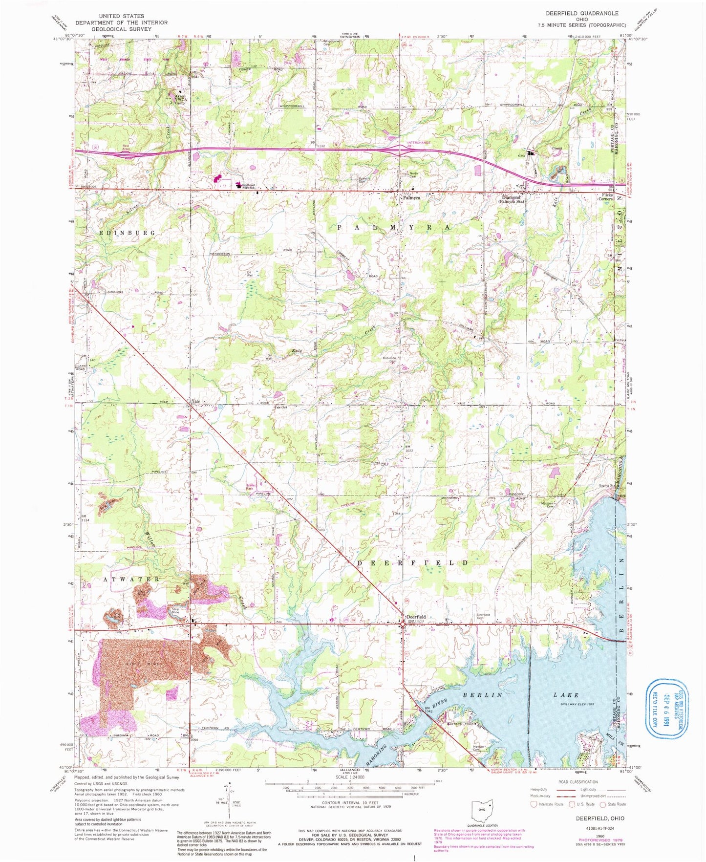
Classic USGS Deerfield Ohio 7.5'x7.5' Topo Map
Couldn't load pickup availability
Historical USGS topographic quad map of Deerfield in the state of Ohio. Map scale may vary for some years, but is generally around 1:24,000. Print size is approximately 24" x 27"
This quadrangle is in the following counties: Mahoning, Portage.
The map contains contour lines, roads, rivers, towns, and lakes. Printed on high-quality waterproof paper with UV fade-resistant inks, and shipped rolled.
Contains the following named places: Akron Y W C A Camp, All Seasons Lake Park, Berlin Dam, Berlin Lake, Bloody Corners, Davis, Deerfield, Deerfield Cemetery, Deerfield Fire Department, Deerfield Post Office, Deerfield Station, Diamond, Diamond Post Office, Flicks Corners, Hayden Cemetery, Hutson, Ireland School, Karas Farms, Keans, Lloyd, Lloyd Post Office, Mill Creek, Mottown Cemetery, North Cemetery, Palmyra, Palmyra Cemetery, Palmyra Post Office, Palmyra Township Fire Department, Robinson Cemetery, Silver Creek, Southeast Elementary School, Southeast High School, Southeast Middle School, Township of Deerfield, Township of Palmyra, Whippoorwill Cemetery, Whippoorwill School, Willow Creek, Yale, Yale Church, Yale Post Office, ZIP Codes: 44411, 44412