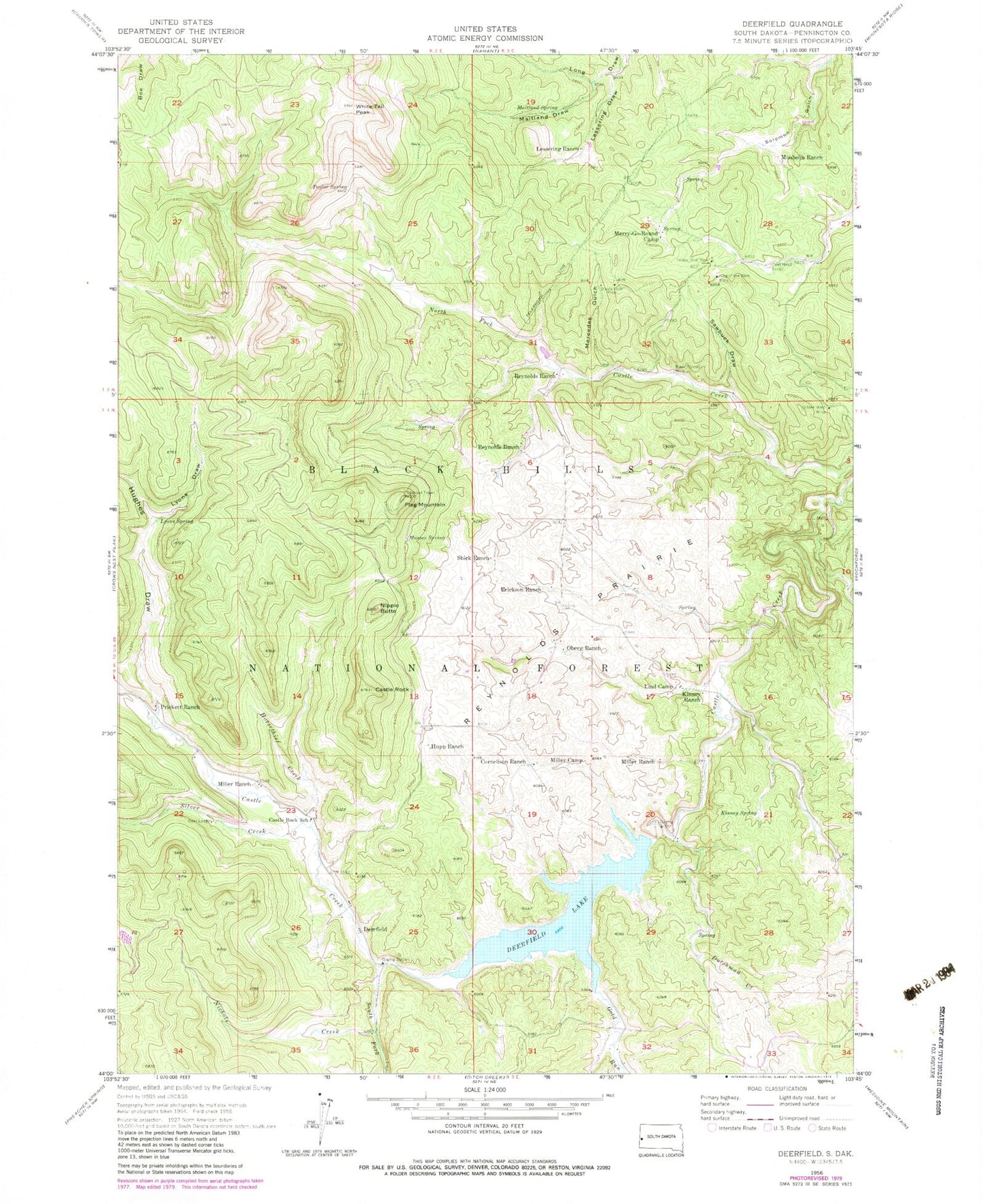
MyTopo
Classic USGS Deerfield South Dakota 7.5'x7.5' Topo Map
Couldn't load pickup availability
Historical USGS topographic quad map of Deerfield in the state of South Dakota. Map scale may vary for some years, but is generally around 1:24,000. Print size is approximately 24" x 27"
This quadrangle is in the following counties: Pennington.
The map contains contour lines, roads, rivers, towns, and lakes. Printed on high-quality waterproof paper with UV fade-resistant inks, and shipped rolled.
Contains the following named places: Alta, Black Hills National Forest, Black Tunnel Mine, Castle Rock, Castle Rock School, Copper Camp, Cornelison Ranch, Custer Trail Campground, Deer Head Lodge, Deer Lodge, Deerfield, Deerfield Dam, Deerfield Lake, Deerfield Lake Boat Ramp Campground, Deerfield Lake Recreation Area, Deerfield School, Divide Lode Mine, Dutchman Campground, Dutchman Creek, Erickson Ranch, Flag Mountain, Gold Run, Gold Run Campground, Golden West Mine, Horsethief Creek, Hughes Draw, Hupp Ranch, King of the West Mine, Kinney Ranch, Kinney Spring, Lake Shore Picnic Area, Lessering Draw, Lessering Ranch, Lind Camp, Lyons Draw, Lyons Spring, Maitland Draw, Maitland Spring, Mercedes Gulch, Merry-Go-Round Camp, Miller Camp, Miller Ranch, Monheim Ranch, Mountain City Picnic Area, Musser Spring, Nichols Creek, Nichols Creek Gravel Pit, Nipple Butte, Oberg Ranch, Pinedate, Prickett Ranch, Reynolds Prairie, Reynolds Prairie School, Reynolds Ranch, Sawbuck Draw, Shakopee Mdewakanton Sioux Community, Shick Ranch, Silver Creek, South Fork Castle Creek, Taylor Spring, White Tail Peak, White Tail Peak Campground, Yellow Bird Mine, ZIP Code: 57745